
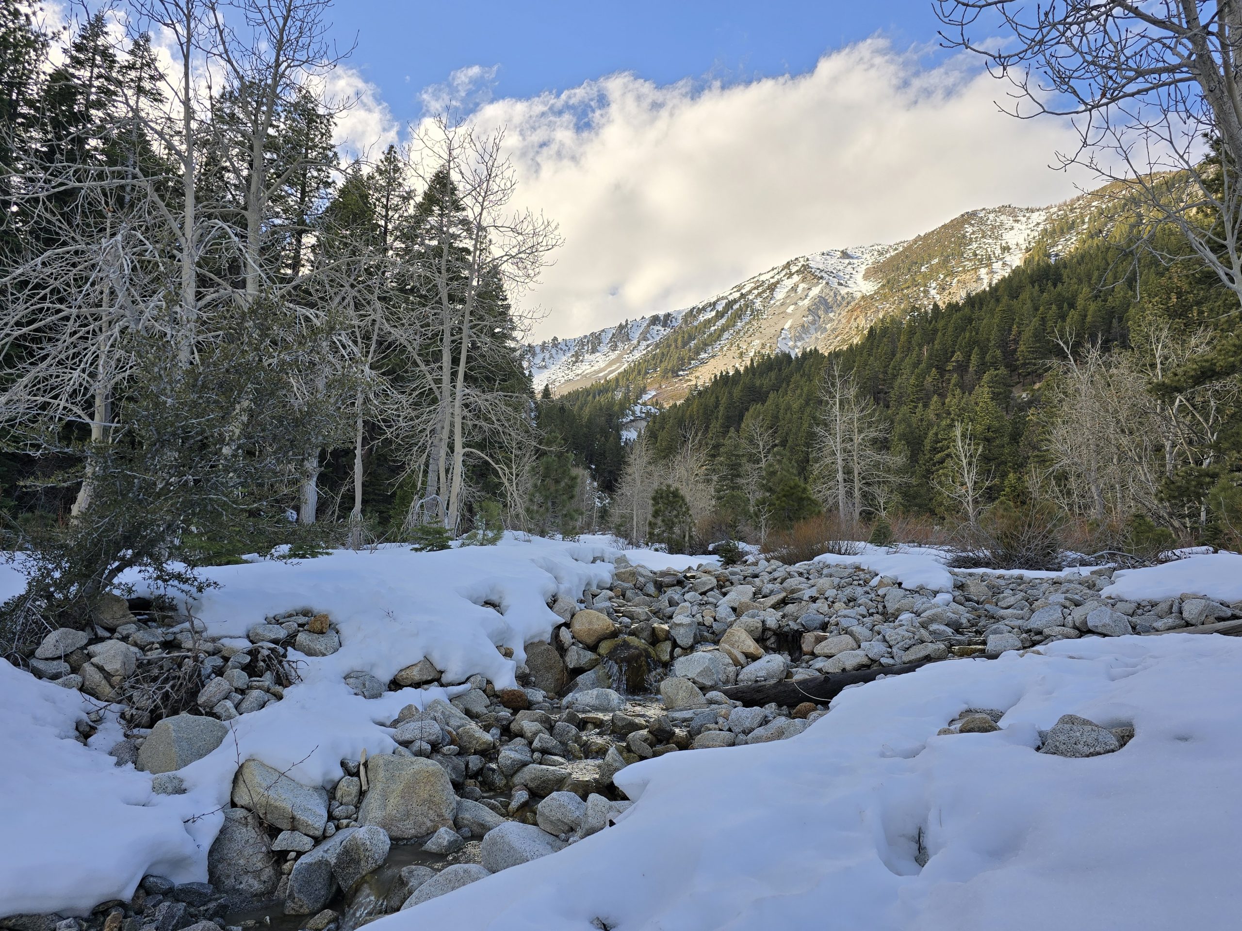
Fall weather in Tahoe was rather accommodating, so we tried to get out and enjoy it as much as possible. This year, the degree of fall colors was highly variable, even within the same area. I was hoping to time a hike to Lost Lake with the leaves, but we ended up being probably a week early. The trail still went through some beautiful terrain.
Compared to most of our hikes, this one was fairly close to home, but on the west shore. We navigated to the subtle trailhead and started making our way through the forest. Very soon, surrounded by amazingly huge and beautiful cedar trees, Jeffrey pines, sugar pines, and ponderosas, I was in heaven. The trail was serene.


The walk through the forest amongst the huge trees was probably my favorite part of this hike.
We also came upon signage indicating we were on a section of the 1960 Winter Olympiad X-Country Ski Trail.


Some slight fall colors showing through along the hike to Lost Lake.


This thick vegetation along our Sierra trails is fairly uncommon.

Manzanita, however, is not uncommon.

After wandering through the woods, we came upon a little watering hole that likely has accompanying flowing cascades earlier in the season.


I just love how clear the water is, even in this shallow, stagnant pool.


Eventually, we emerged from the woods to an open expanse among the rocks and boulders.


And with that, the terrain also shifted from dirt and pine needles to rocks and boulders as we continued to ascend.


Parts of the trail turned fully into granite slabs, and in some areas, in order to find our way, we had to look for cairns (stacked rocks) and – oddly – mountain bike tire tracks in scant deposits of sand or dirt in the crevices of the granite slabs. Both of us were dumbfounded that anyone would consider riding a mountain bike on this trail, but in fact, a local organization was actually in the process of developing the trail for mountain bikers. (I am not a mountain biker, but my husband has been for decades, and he couldn’t believe all the tire tracks we were seeing.)
At this point in the trail, we arrived at the junction for the Rubicon OHV Trail, one of the most famous and challenging off-highway vehicle (OHV) trails in North America. Built-up Jeeps come from everywhere to conquer the technical obstacles the 22-mile Rubicon is known for. In fact, the Jeep Wrangler “Rubicon” gets its namesake from this trail. At any rate, we went left at the junction.

The weather was perfect and hearing the birds singing and flitting around us on this wooded section of trail in between slabs of unforgiving granite added a certain serenity to this hike.
A broader view of Lake Tahoe from the west shore was revealed in the landscape as we climbed higher on the granite trail.

And… another crime scene.

A cluster of mushrooms had taken up residence inside a decaying felled tree along the trail.

After what was starting to feel like a long seven miles, I finally caught a glimpse of Lost Lake up ahead through some trees.


Before heading back, we sat on some boulders along the shoreline and enjoyed quick snacks while gazing out at the lake.
On my beeline to Lost Lake, I was so laser focused on getting to our destination once I spotted it in the distance that I didn’t even notice little Duck Lake on the opposite side of the trail, so we ventured over there on our return.


Not long into our return route, I stopped dead in my tracks.

Absolutely, the biggest garter snake I have ever seen. I wasn’t going to get any closer to it, otherwise, I’d have set my foot next to it for scale. We estimate it was about 3 feet long.

I know in the world of slithering reptiles, garter snakes are pretty harmless, but I have made it known before that I have a completely irrational fear of snakes. All snakes. Even the “nice” ones.
This is me fleeing the snake.

Then we had to re-climb the granite slabs, rocks, and boulders again.


On our return through the enchanting forest near the beginning of the hike to Lost Lake, I was a ways ahead of my husband, admiring the giant trees and moving at a good clip, and I missed the barely noticeable turnoff for our trail back to the Jeep, so I kept hiking at a very swift pace down the wrong trail. A quarter-mile in, I got a message on my phone from my husband, asking if I was on the correct trail. I quickly realized I wasn’t and had to turn around and meet back up with him at the correct junction. So, that was a waste of energy!
After logging a distance of about 14 miles and roughly 1,800 ft of elevation gain under our feet, we arrived back at the trailhead and proceeded to Tahoma Market & Deli for a delicious and well-earned late lunch/early dinner.
In all, it was a beautiful day for a 14-mile fall hike to Lost Lake. I wish the leaves would’ve had a bit more color to them, and the two lakes we hiked to (Lost and Duck) were a little lackluster compared to some of the lakes we’ve hiked to, but the huge trees were amazing and, as always, it was just really awesome to get to spend this beautiful fall day outdoors, taking in the fresh air and sunshine. I can think of much worse ways to spend a Sunday afternoon.
Lost Lake Hike Stats

| Lost Lake Hike | |
|---|---|
| Total Distance | 14.13 mi |
| Total Time | 5:39:44 |
| Total Ascent | 1,788 ft |
| Max Elevation | 7,593 ft |
Leave a Reply