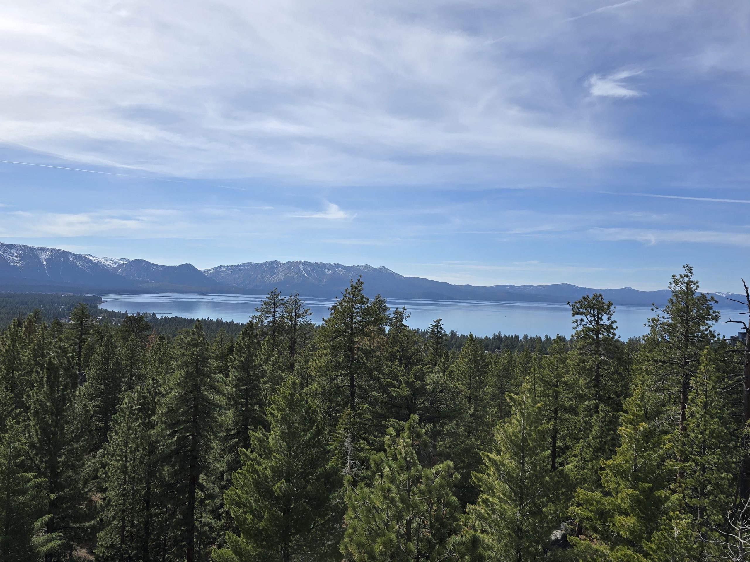
The snowfall in Tahoe during March 2026 was sparse, which works well for early-season hiking. 😬 We were seeking a local hike, but one with some distance and elevation gain, yet hopefully little to no snow to trudge through. In Stateline, NV, and South Lake Tahoe, CA, is Van Sickle Bi-State Park, an area we haven’t yet explored, but it has multiple trails. One of these is the Van Sickle Rim Trail, a connector for the Tahoe Rim Trail (TRT). The route we’d planned strung together a few different trails within the park, taking us past a waterfall and offering stunning overlook views of Lake Tahoe, ultimately leading out to the TRT, which was where we’d planned to turn around.
Van Sickle Bi-State Park History
According to Nevada State Parks:
“As a memorial to his late grandfather Henry Van Sickle, Jack Van Sickle donated 542 acres of his land to the State of Nevada in 1988 to create a new Nevada State Park. Subsequently, the State of California purchased the adjacent land, the Van Sickle family’s former Crescent V Ranch, to connect the park to the community of South Lake Tahoe.
The ranch’s barn, a circa-1914 log cabin, and housekeeping cabins from the 1930s-era Three Pines Motel, were all relocated to their current location in 1960. The Van Sickle family operated the Stateline Stables on the site until 1993, with up to 60 horses taking riders on trails throughout the area, creating unforgettable memories for many of Tahoe’s vacationers.
Opened to the public in the summer of 2011, the park is managed by the Nevada Division of State Parks in partnership with the California Tahoe Conservancy.”
Parking for Van Sickle Bi-State Park
Vehicles are only allowed in Van Sickle Bi-State Park from May 1 – October 31, so we had to find parking elsewhere. Various parking options are available in the vicinity of the park, including free street parking, but we opted to park in a paid lot adjacent to the park entrance.
Barn Trail
We geared up and headed out on the pavement, crossing the street to Van Sickle Bi-State Park, where we jumped on a trail that almost immediately began ascending, winding past the old cabins from the site’s history.
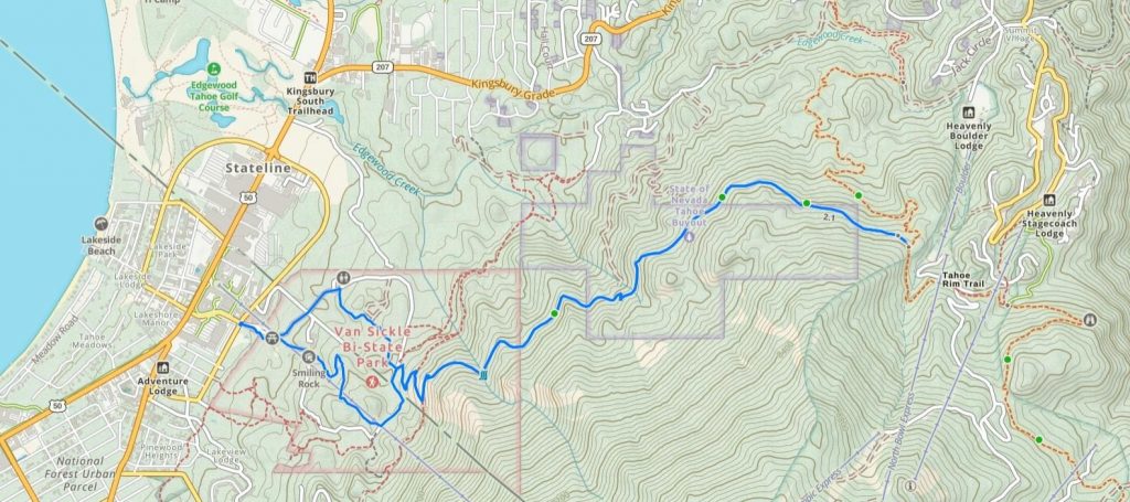
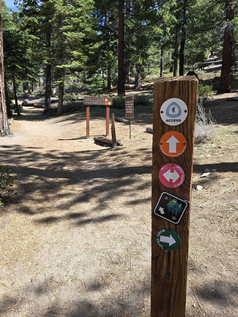
The trails within the park are labeled clearly, but I will say that because there are numerous routes and connectors, it is important to know which route is the one you want to be on to arrive where you intend. The first section we took was called Barn Trail.
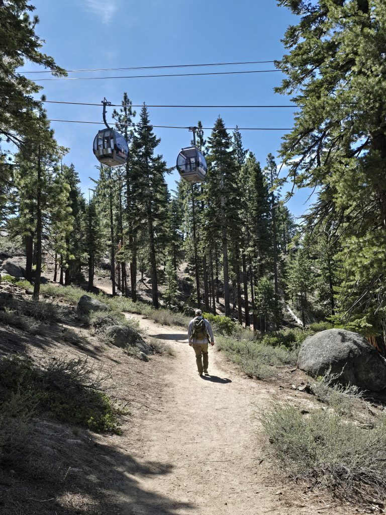
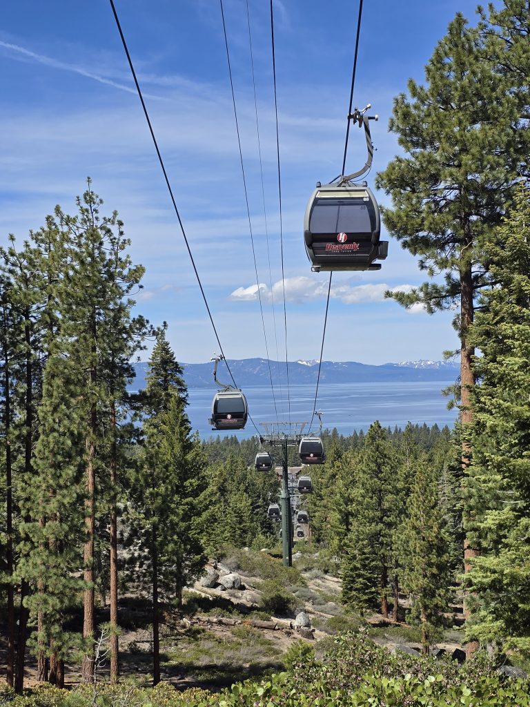
Heavenly Gondola
The beginning of the route goes directly under the Heavenly Gondola, which isn’t something we encounter on many hikes. (Yes, it runs year-round, and the moving shadows it created would periodically startle me on the trail!)
Cal/Neva Loop to Van Sickle Rim Trail
From Barn Trail, we switched over to the Cal/Neva Loop Trail, and continued climbing up toward the Van Sickle Waterfall.
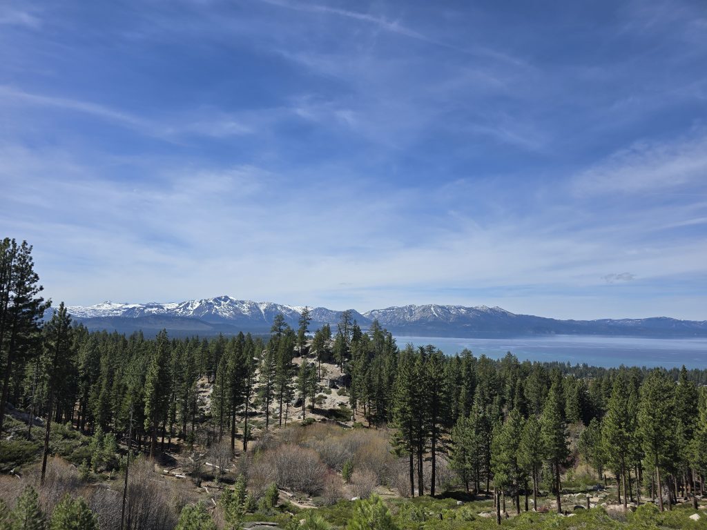
We were rewarded along the way with amazing views of Lake Tahoe from above.
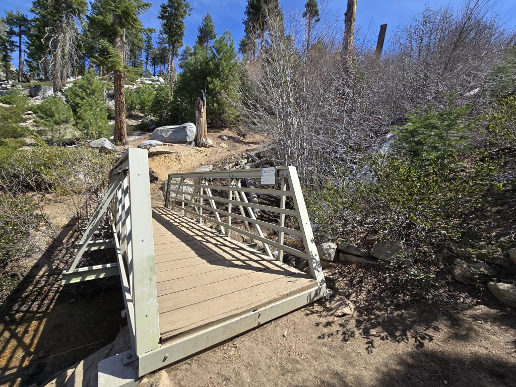
Van Sickle Waterfall
The final stretch up to the waterfall is a little bit of a steep grind. In about three-quarters of a mile from the start, we reached the footbridge and Van Sickle Waterfall.
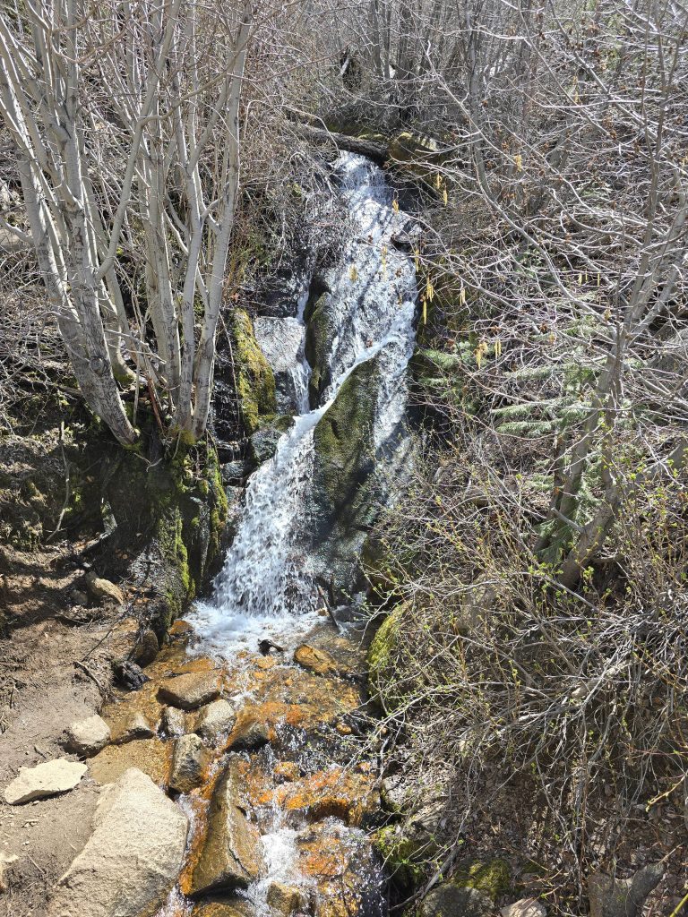
Over the years, we’ve hiked to some incredible waterfalls. As far as waterfalls go, this one was a little lackluster, honestly, but I can see why people like to take a quick hike up there and have a picnic lunch. After a short, steep hike, you can enjoy the pretty waterfall and the awesome views.
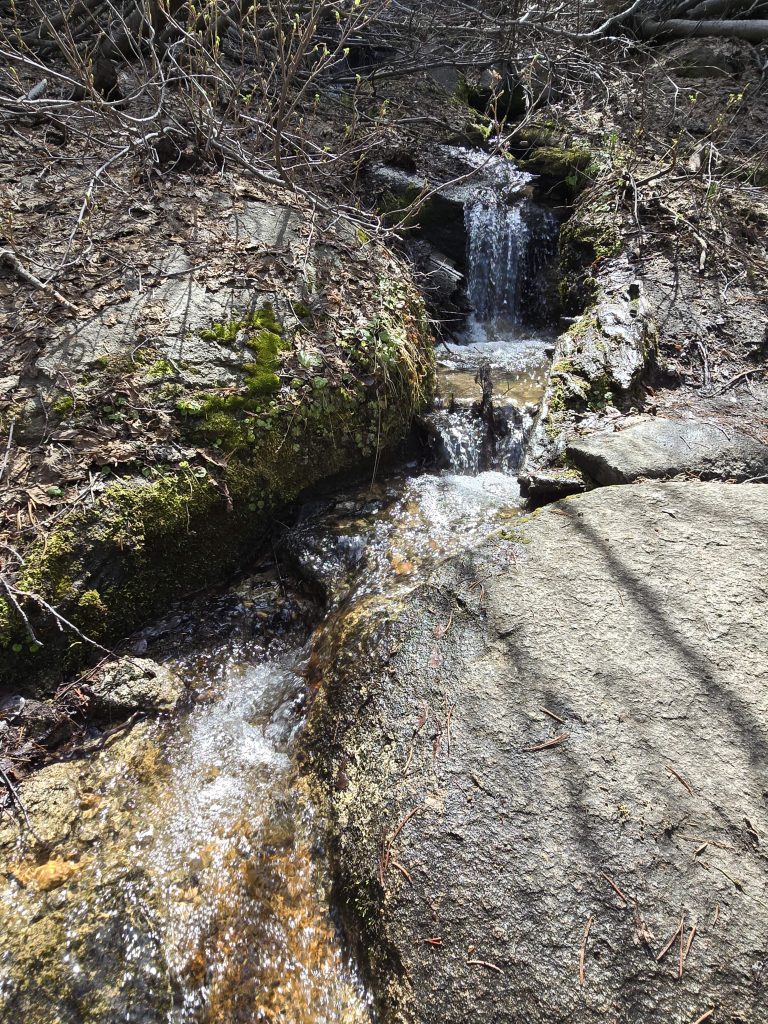
We had several miles left in our hike, so we didn’t linger very long at the falls. A short distance beyond the falls, we encountered small creek cascades alongside the trail.
Van Sickle Rim Trail to Tahoe Rim Trail
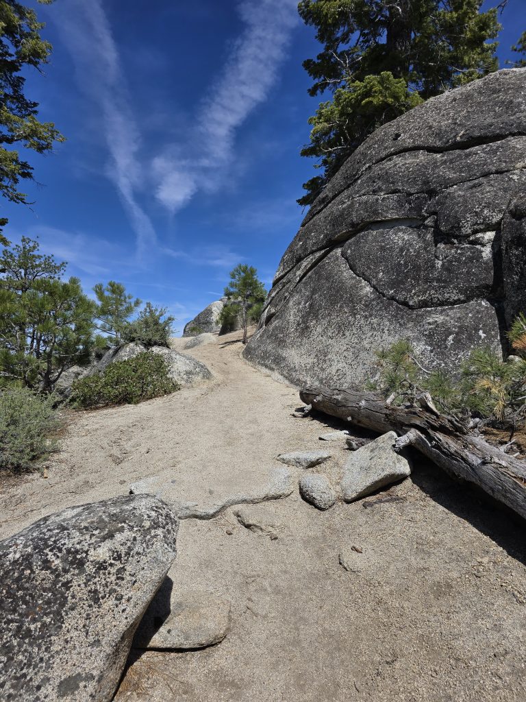
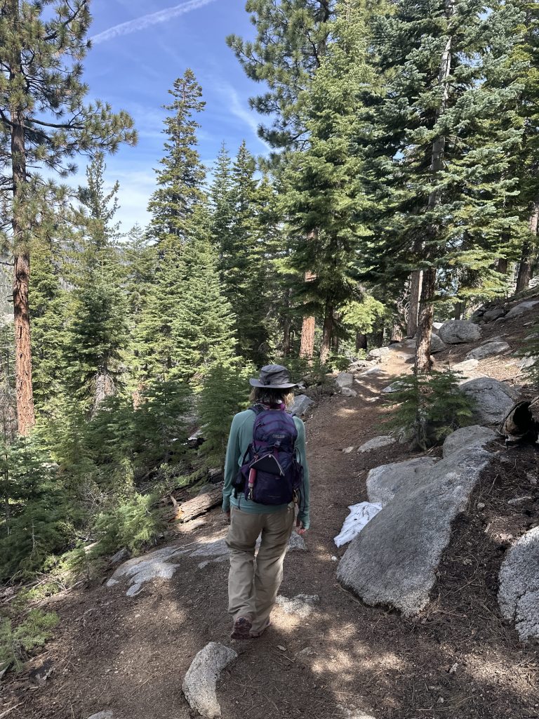
The trail leveled out and transitioned from granite boulder terrain to a forested terrain, also changing from fully exposed sun to moderate shade.
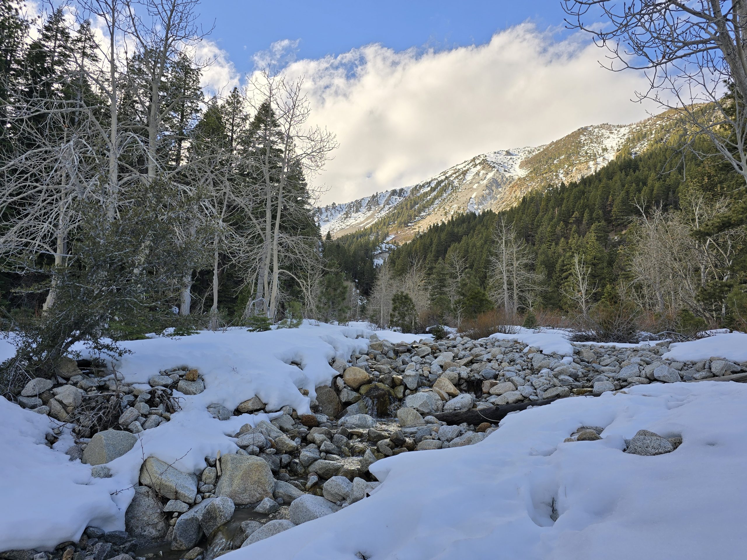
Then, we ran into a snowy trail section. It wasn’t a lot of snow, but its late-season slippery condition made it a bit challenging to cross.
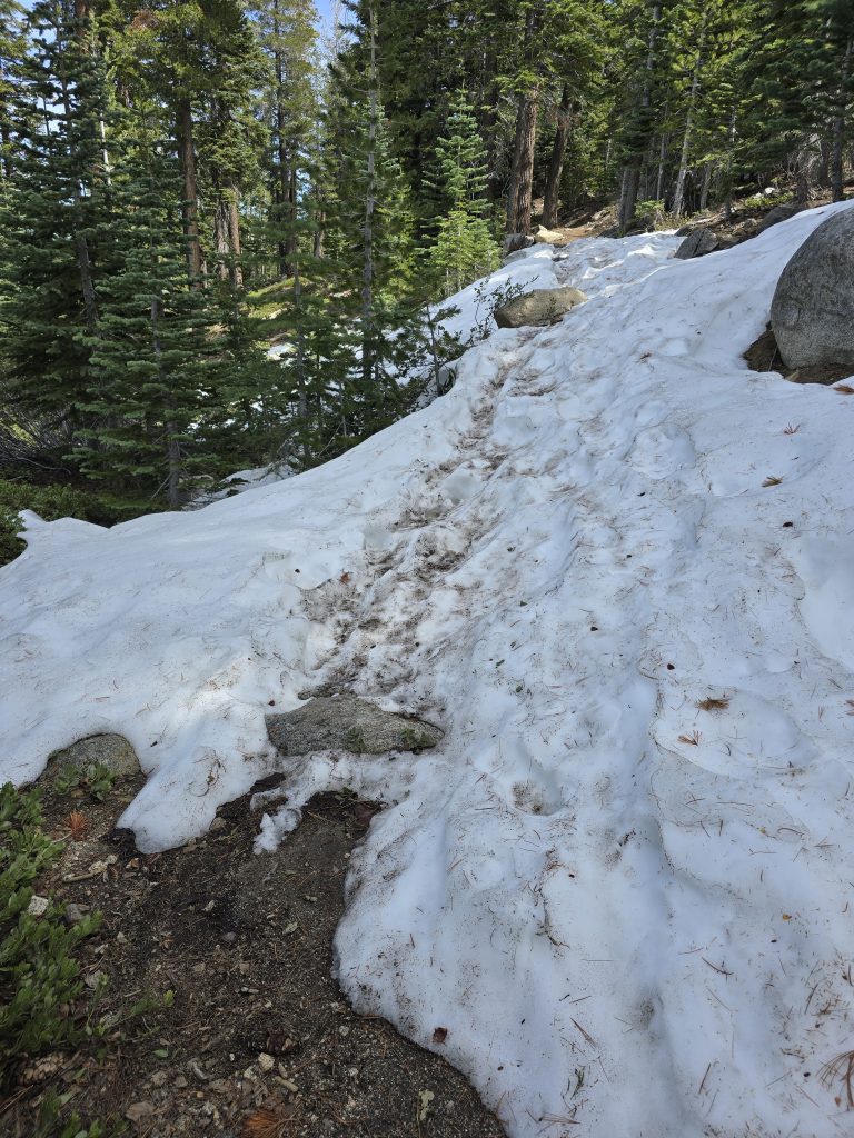
In fact, a few other sections of the trail were also snow-covered, which felt gravely disappointing at the time. It seemed like the remaining three miles to the intersection with the TRT was taking a very long time. We just kept hiking and hiking and hiking, with no sign of the TRT. I was getting concerned that the map was inaccurate.
We even crossed paths with another solo hiker, who was coming from the opposite direction. He asked us how far he’d have to hike before he could get good views of Lake Tahoe. We told him he’d have to go a bit farther for that, and we mentioned we were looking for the TRT crossing as our turnaround, and he did not respond with anything like, “Oh, that’s just up around the corner, you’ve not got much farther to go…” In fact, he didn’t respond to the TRT reference at all, which also made me wonder if the map was leading us astray!
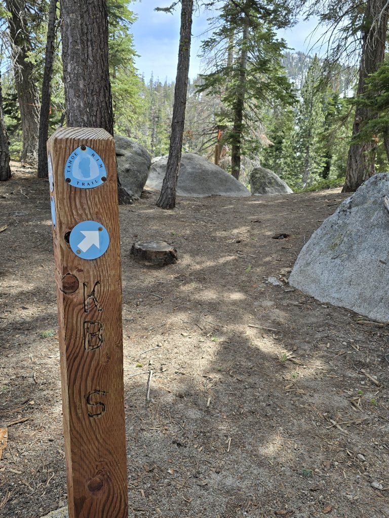
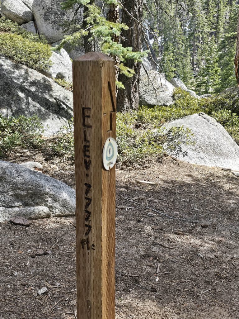
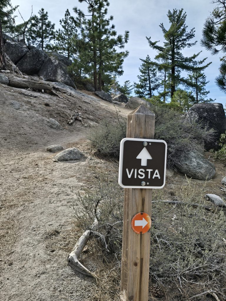
Tahoe Rim Trail Crossing & Vista
But, finally! At long last, we reached the trail sign for the TRT! Maybe it was the multiple taxing snow patches, or it simply being an early-season hike, but for some reason, it felt like so much longer than roughly 4 miles.
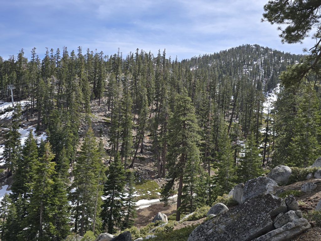
At this TRT trail intersection was also a vista. We were at the top of where Heavenly’s Boulder and North Bowl Express chairlifts meet. What’s funny is that about a month prior to this hike, my husband had been skiing this very terrain with his nephew, who flew out from Minnesota. As you can see from the photos, there would be no skiing today!
We were happy to reach our turnaround point, have a quick snack, and head back toward the trailhead to enjoy some of the return-route lake views again. If we were up for adding more distance to this hike, we could have hopped on the TRT and continued toward Kingsbury Grade and beyond, but that wasn’t in the plan for today.
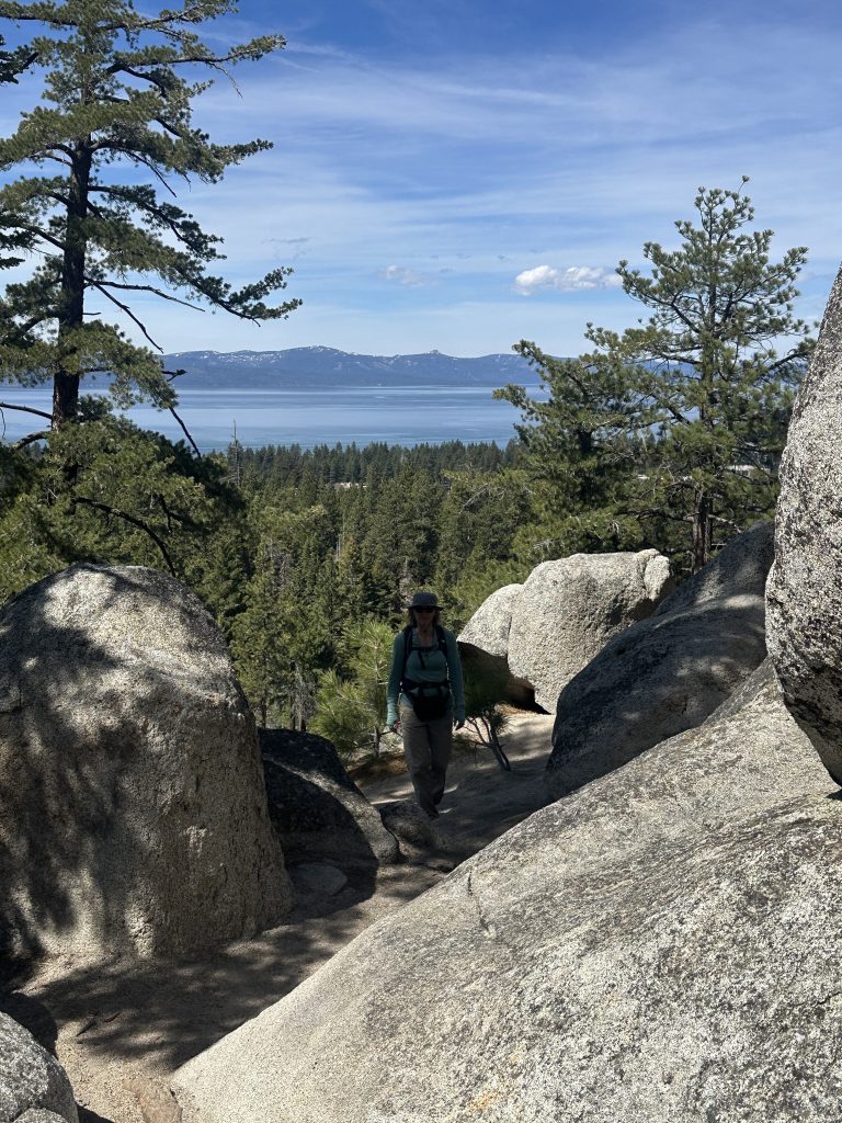
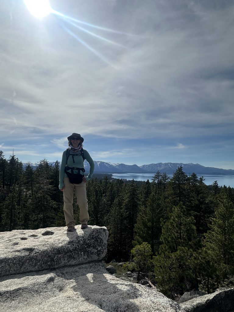
Scenic Overlook on Van Sickle Rim Trail
On our way down, we stopped at the vista overlook and climbed on top of the boulders to check out the view.

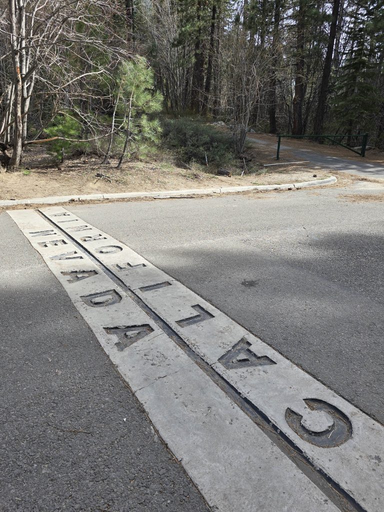
After descending from the vista, we decided to take a slightly altered route back to the trailhead, which resulted in walking on the paved road through the state park for a little while, where we came upon the state line marking, indicating the border of Nevada and California inside the park.
Overall, this hike in Van Sickle Bi-State Park wasn’t the most exciting, but for a local, early-season hike with moderate mileage and elevation gain and a few heart-pumping ascents, along with the amazing vistas and lake views, it was a decent option.
Van Sickle Rim Trail Hike Stats
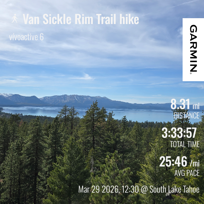
| Van Sickle Rim Trail hike | |
|---|---|
| Total Distance | 8.31 mi |
| Total Time | 3:33:57 |
| Total Ascent | 1,739 ft |
| Max Elevation | 7,799 ft |
Leave a Reply