
We’ve been hiking in Tahoe since 2014. A few years in, I started experiencing periodic knee issues with pain, especially on a steep-grade descent. It’s something that has annoyingly plagued me off and on and it eventually subsided, or so it seemed. That is, until the end of last season, when it was alarming enough I decided to go back in and get it checked out to make sure it wasn’t something more serious that required surgery. The response was, yet again, physical therapy. Since January, I’ve been implementing a consistent strength-building regimen, so I was looking forward to testing out my “new legs” on a hike soon.

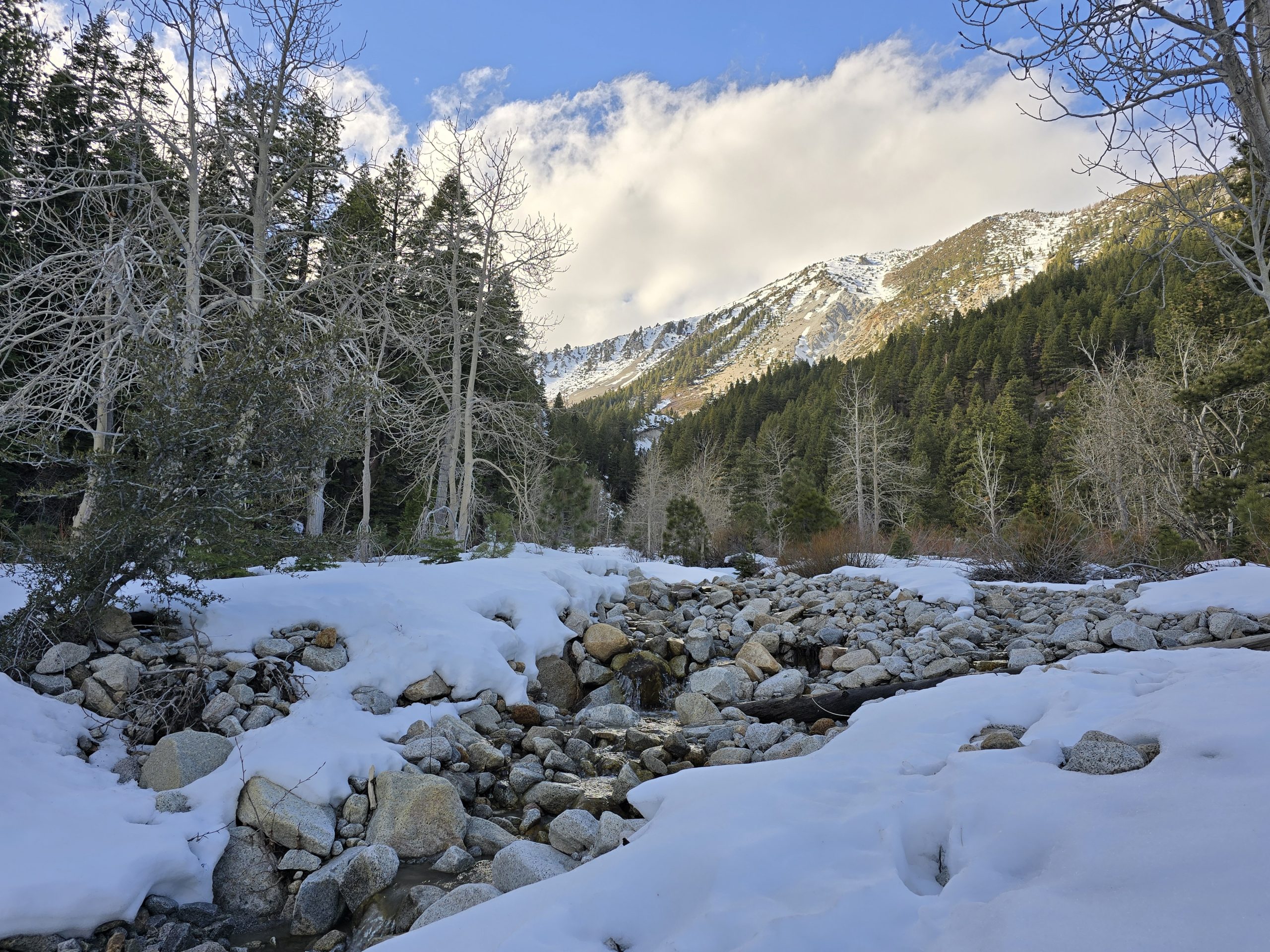
After several weeks of unsettled winter/spring weather in Tahoe – including 10 inches of snow at our house last week and 28 inches at Squaw Valley – I’ve been itching to get out and hike. But hiking in the high country would be a tough winter trek at this point.
We might have turned a corner weather-wise this past weekend, but don’t hold me to that. To take advantage of it, nonetheless, we headed down to Reno for a “local” hike that we haven’t yet done. Since it’s early in the season and we recently had precipitation, this 30-foot waterfall should be flowing pretty nicely.
Everything we read about the hike ahead of time noted that the trail would be busy, especially on a Sunday afternoon with clear blue skies and sun. When we arrived, the main parking areas were full and overflow cars were lining both sides of the connecting street. We didn’t have to walk too far to join the trail.
All in all, we came across dozens of varied hikers – all ages and experience levels, many of whom were being towed by their furry friends. I was pretty excited to, basically, be out on our first hike of the season, and the weather was beautiful, so I kept an aggressive pace on the way up, which was just over 1200′ of vertical gain across a little over 3 miles. But with all of the foot traffic along the way, I ended up slowing down and/or stopping quite a bit. One thing I noticed, though, was that my legs felt “mechanically” different. They definitely felt stronger, more stable, and overall different.
The trail terrain waned from dusty dirt, dried mud, and sloppy mud to rocks and bigger rocks. No sections of the hike were particularly steep or unrelenting, but you were definitely climbing to get to the falls.
At the outset, surrounding you were peaks and valleys of rocky sagebrush with pockets of aspens, and as you increased in elevation, you were amongst towering evergreen trees and a pine-needle-covered trail. But almost the entire time you could hear Hunter Creek rushing down below, as one side of the trail often had a steep 75-to-100-foot drop-off down to the creek.


The first little stone-stepping water-crossing on this hike. I always love these.

I also loved that this little “creek” wound its way through a pine-needle-covered ground. It’s like, “Excuse me. I’ll just make a little creek here.”

I really pushed myself on the way up and I made it to the falls in an hour. As I neared the area at the falls, it became a little unclear which leg of the trail to take next. Across the creek, I could see people perched on stumps and bent branches and it seemed like that side offered the best view of the falls. So… how do I get over there…
Sure, this stick pile ahead of me seemed sketchy, but walking across stick “bridges” isn’t uncommon on hikes. I made it halfway across this mess before I turned around, nearly losing my balance and falling in, deciding that I would check out an alternate route.

Taking a different section of the trail, it led me directly to the falls, but the view was pretty obstructed and there were a number of people crowding the area.
So, I backtracked a little bit and found another stick bridge that seemed slightly lower on the sketch-factor scale, so I carefully made my way across it to the opposite side. It was still pretty sketchy, but I didn’t fall in.

I wandered over between the tall trees to get a closer view of the falls. And that’s when I saw it. A very sturdy downed tree across the creek. Huh. That seemed a lot easier than the stick bridge I balanced across.

Anyway, the falls were roaring and I loved the smell of fresh mountain water vapor in the air.
It’s not the biggest of cascades, but it was a lovely and serene scene. I will say, when we decided it was time to head back down to the trailhead, I took the sturdy log crossing rather than the sketchy stick bridge.
On the descent, I took a much slower pace, stopping to take a bunch of photos of things I’d not paid attention to as I was racing to the top.
The few deciduous trees were beginning to bud out and I was pleasantly surprised at all of the wildflowers in bloom along the trail.


Spreading phlox. Their petals turn pink or purple after pollination.

This is definitely Paintbrush, just not sure if it’s Applegate’s or Giant Red.


These unique, tiny yellow flowers caught my eye on the return trek, and I thought to myself, “Well, don’t those look like little fiddleheads.” It turns out they are called common fiddleneck.


I found myself in a few precarious positions along the edges of the trail to capture some of the wildflowers. Luckily, none resulted in anything tragic, but I do suspect other passers by were wondering what I was thinking or what I was doing.
Overall, it was a nice hike and offered plenty of challenging terrain, pretty scenery, and fragrant florals. Most of all, it was just wonderful to be outside on that beautiful day and get a spring hike in.

| Hunter Creek | |
|---|---|
| Total Distance | 6.4 mi |
| Total Time | 2:30:46 |
| Total Ascent | 1,266 ft |
| Max Elevation | 6,123 ft |
Leave a Reply