A few weeks ago, we hiked up to Mt.Rose again, and we chose yet another “close to home” adventure this weekend with a hike to Rifle Peak, starting from Tahoe Meadows. We’d been up to Rifle Peak several times over the years, taking various routes, but this was our first time seeing wildlife up there.
Hike to Rifle Peak
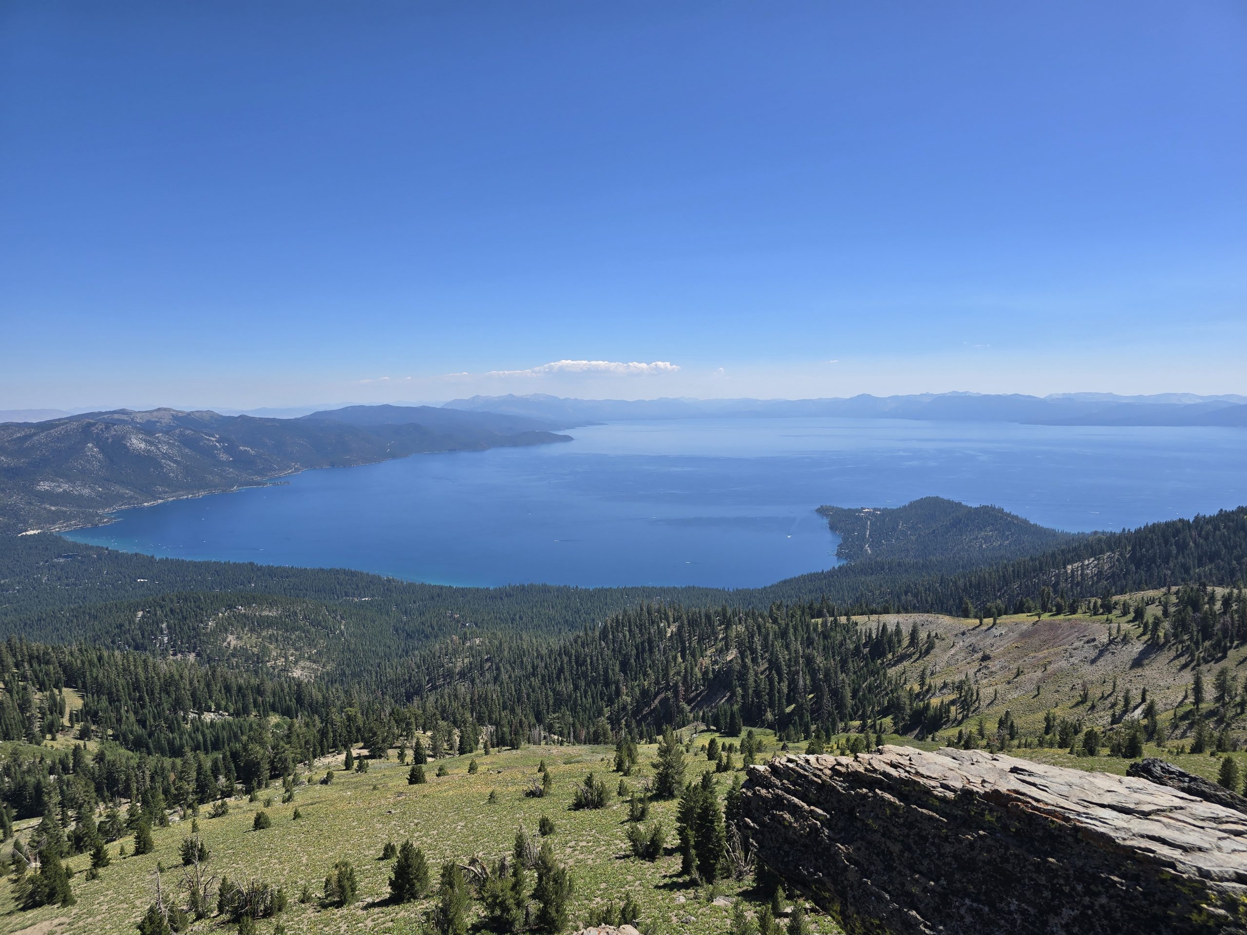
The hike to Rifle Peak from Tahoe Meadows was 9.68 miles round-trip for us with 1,883 feet of elevation gain. The first 1.7 miles or so of this route kicks you right up to 9,276 ft. via the familiar constant uphill climb to the spur that leads to Incline Peak, a favorite destination I enjoy hiking to and have done so numerous times.
Thankfully, the grade after emerging from the tree line levels off considerably, with only a few milder ups and downs until you reach the steeper spur that winds you up to Rifle Peak.


Wildlife Sightings on Hike to Rifle Peak
As we were enjoying the gradual Tahoe Rim Trail section of this route, we were winding around a bend, and something moving caught my eye up the mountainside.


Because the wind was blowing in the opposite direction, the deer likely couldn’t smell us, nor did they see us right away, so we were able to get quite close to them initially.
It is not uncommon to cross paths with mule deer while hiking in the Sierra, but we’ve never seen them up this high on a hike before, so that was an unexpected treat for us!
In fact, several years ago, we were hiking on Fay-Luther Trail to Knob Point above Carson Valley. We’d stepped off the trail to sit on a boulder to have a snack, and suddenly, this parade of mule deer appeared. 😂
In addition to the mule deer, we also spotted an American Kestrel perched atop a dead tree.

After about 2.5 hours of hiking, we arrived at the top of Rifle Peak and took in the incredible expansive views of Lake Tahoe from the north shore.

While perched in the sunshine on the pile of rocks of Rifle Peak, I called my mom (it was her birthday), and we rested and had quick snacks before beginning our descent back to Tahoe Meadows.

In all, the round-trip hike to Rifle Peak from Tahoe Meadows and back took us about 4.5 hours to complete.
Another popular route we’ve taken to hike to Rifle Peak, starting from Marlene Street in Incline Village, is much shorter in distance (just four miles round-trip) but also substantially steeper and more physically challenging. So, we thought we’d try this other route. Both are great options, it just depends on how much time you have and how much of a challenge you’re looking for – long distance or short and steep.
Rifle Peak Hike Stats

| Tahoe Meadows to Rifle Peak hike | |
|---|---|
| Total Distance | 9.68 mi |
| Total Time | 4:36:37 |
| Total Ascent | 1,883 ft |
| Max Elevation | 9,444 ft |
Leave a Reply