My mom hadn’t been to Tahoe since the summer of 2017. The way things worked out in the summer of 2025, my mom and my husband’s mom decided to fly out to Tahoe together and stay with us for a week.
Once the travel plans were solidified, we were thrilled and started mapping out their itinerary. Of course, we tried to pack in as much as we could for their summer visit to Lake Tahoe.
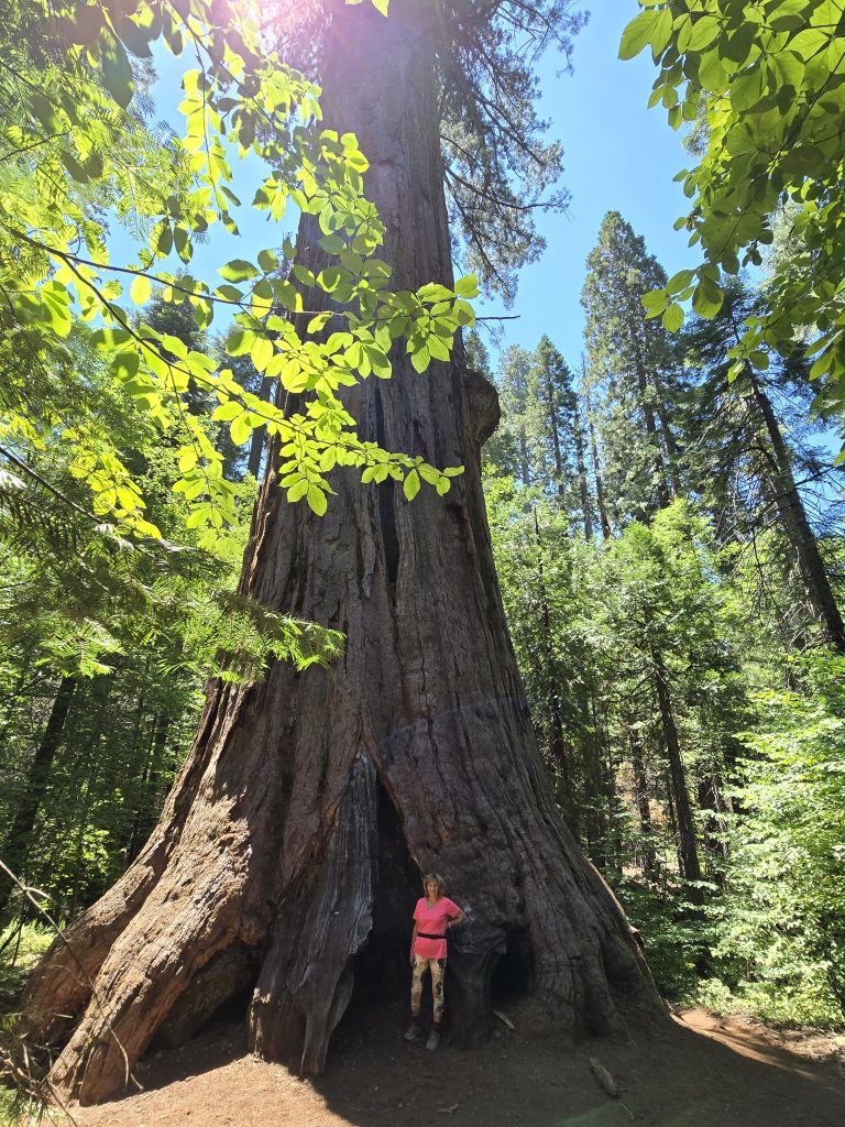
Calaveras Big Trees State Park
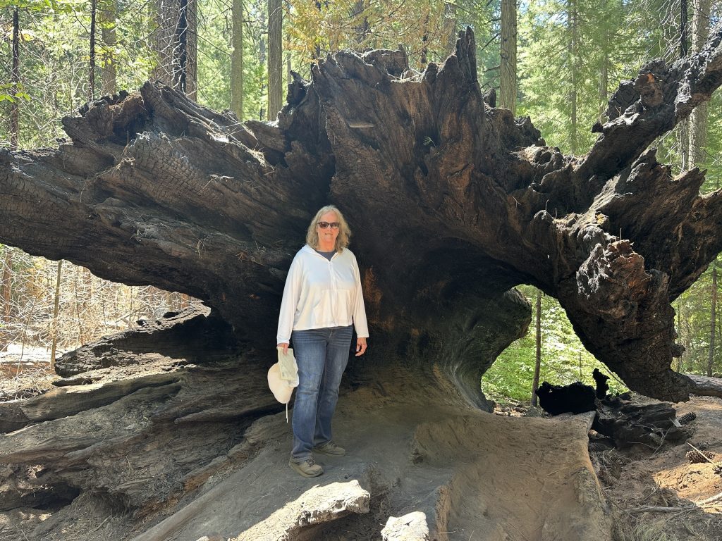
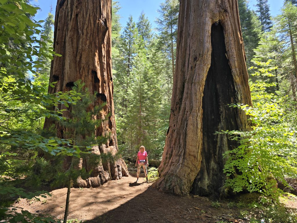
The first activity was to take them to one of our favorite spots, Big Trees State Park, to see the giant sequoias. My mother-in-law had been here with us before, but my mom had not and had never seen such massive trees.
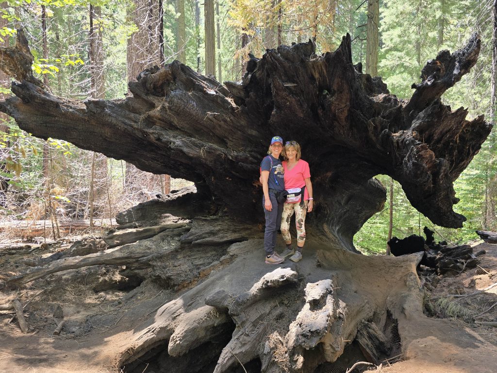
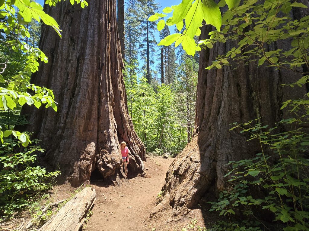
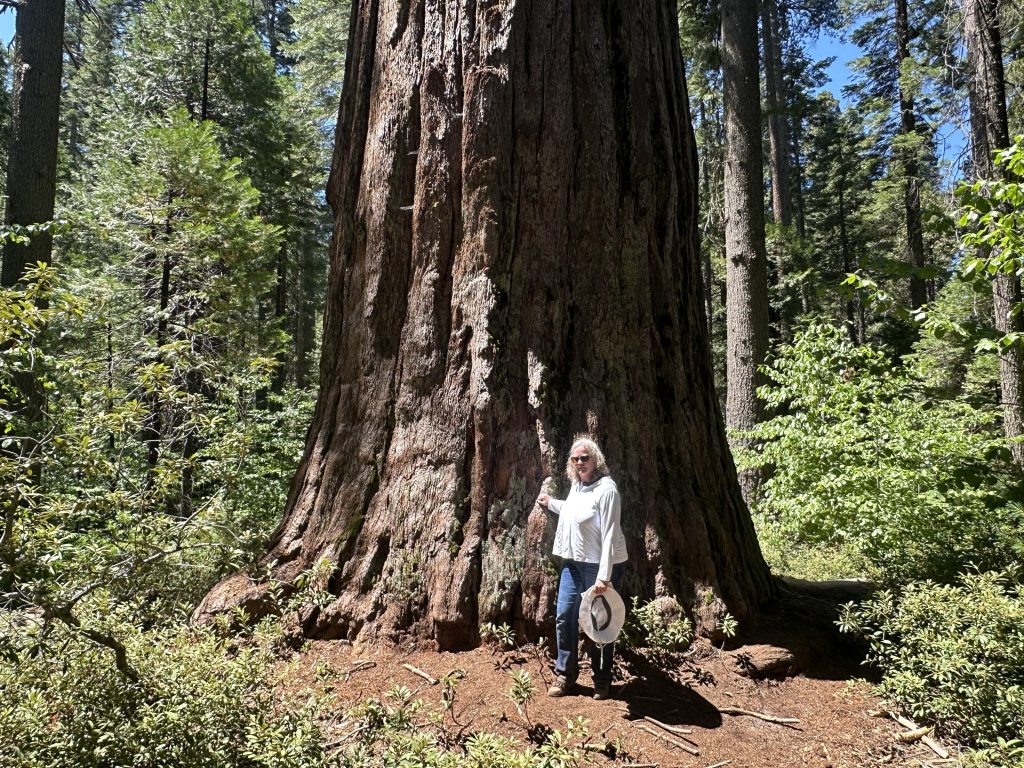
My mom and I hiked the remainder of the South Grove route to Agassiz, the biggest tree in that grove.
We stopped for lunch in Arnold, CA, and then started the 3.5-hour drive back up to Tahoe.
Kayaking on Lake Tahoe
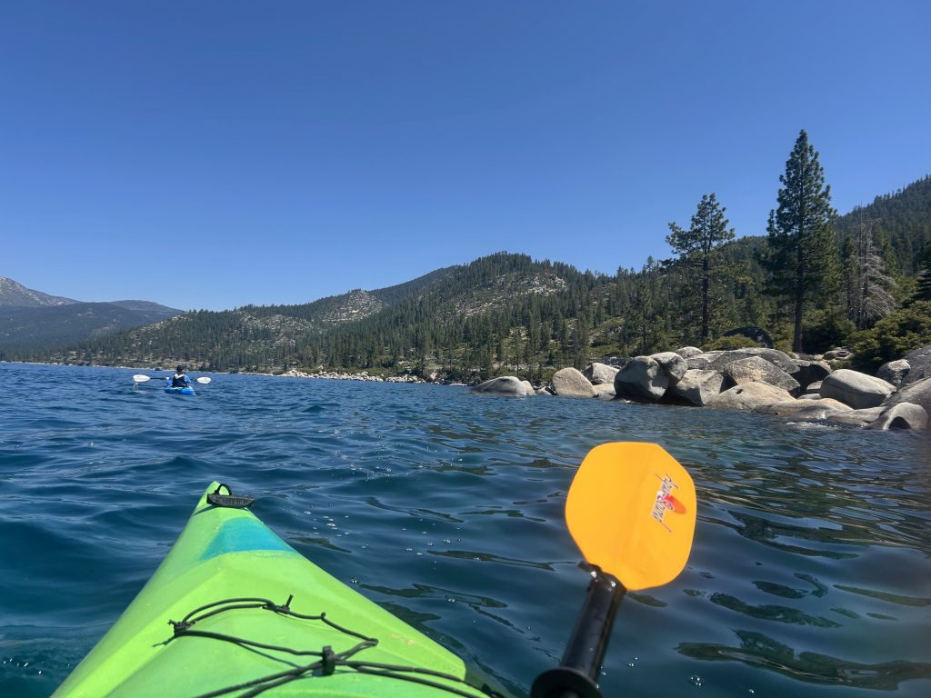
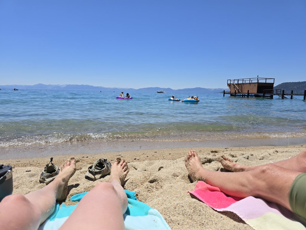
The following day, we got up early and loaded the kayaks to then launch from Incline Beach. My mom has gone kayaking with me on the lake before, but she loved it so much last time that I figured she’d enjoy doing it again. One of the amazing things about Lake Tahoe is that it never freezes, so you can actually kayak on it anytime the weather allows, even in the winter. In fact, we brought my husband’s aunts kayaking in early March, and they had a blast.
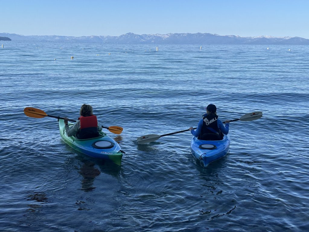
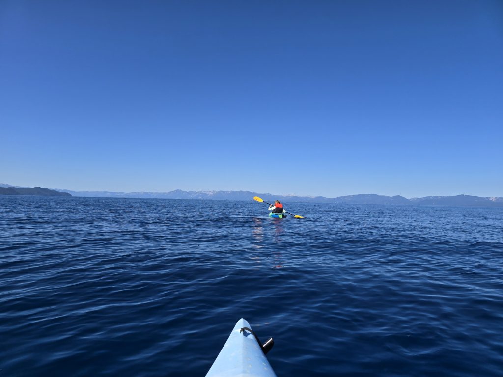
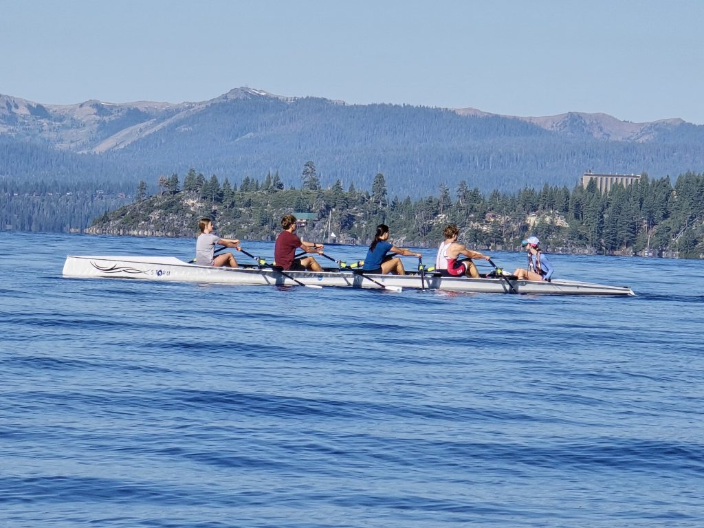
Our plan was to paddle from Incline Beach to Sand Harbor and back. It was a relatively busy summer day on the lake, but luckily, the lake is big, so it did not feel crowded. We saw numerous aircraft as well as various water vessels while we paddled along.
We saw an ultralight aircraft flying over Lake Tahoe while we kayaked.
We saw multiple seaplanes flying over Lake Tahoe today as well.
Along the way to Sand Harbor, I spotted something roundish with brunette hair bobbing in the distance. Lake Tahoe is very clear, and you can see quite a long way down (usually around 75 feet), so when you see something floating in the water, it’s a little alarming.
From the initial distance, the hairy object bobbing in the water looked like the top of a human head, and I’d be lying if I said I wasn’t a little trepidatious to get closer to it for fear of what I’d discover.
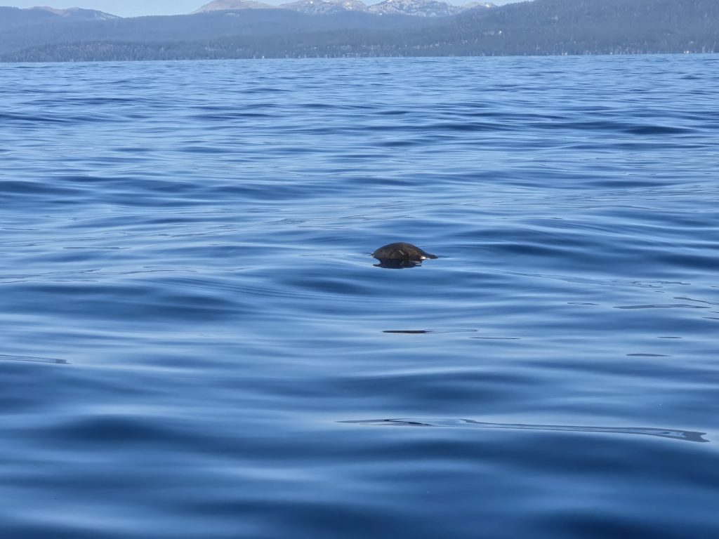
To add to my hysteria, a boat with 10 passengers tragically capsized in Lake Tahoe less than a month prior, and 8 of them drowned. Naturally, my mind briefly went there when I saw this hairy object floating in the water.
As I paddled closer to it, the putrid odor of rotting carcass was almost overwhelming.
When I got a better look at the floating object, I confirmed it was a dead animal, likely a bloated muskrat. Regardless, it was pretty gross, but we were very relieved it was an animal.
After about an hour and a half of paddling, we made it to Sand Harbor, beached our kayaks, and relaxed on the sand for a bit while refueling with some snacks. Then we decided we should probably start heading back to Incline Beach, as the wind often picks up in the afternoon, which could make our paddling even more challenging and tiresome.
The return trip felt like we were battling the wind the entire time, so our arms and shoulders got quite fatigued. By around noon, we made it back to Incline Beach, where we, once again, found an open spot on the sand and leisurely relaxed in the sun, taking in the beautiful Tahoe day.
And another seaplane flew past us while we were sitting on the beach.
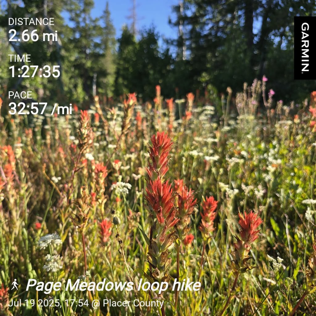
Hiking in Page Meadows
After my mom and I returned from our kayaking excursion, all four of us decided to take a short hike together in Page Meadows before we lost daylight, hoping to catch some leftover wildflowers.
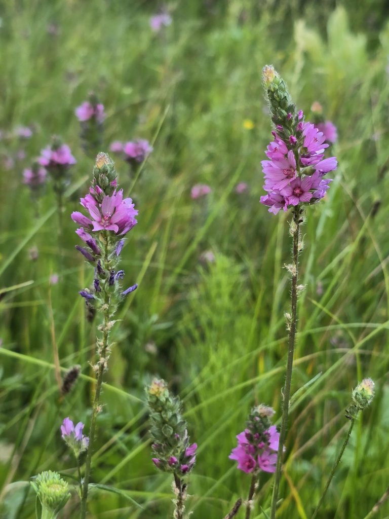
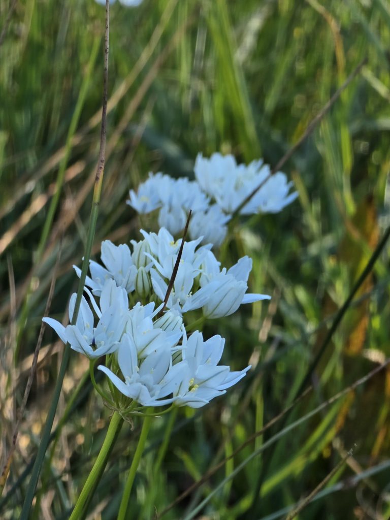
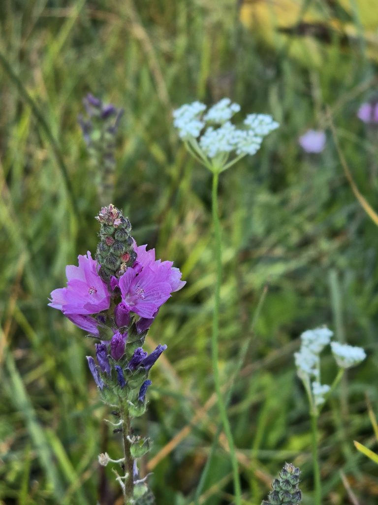
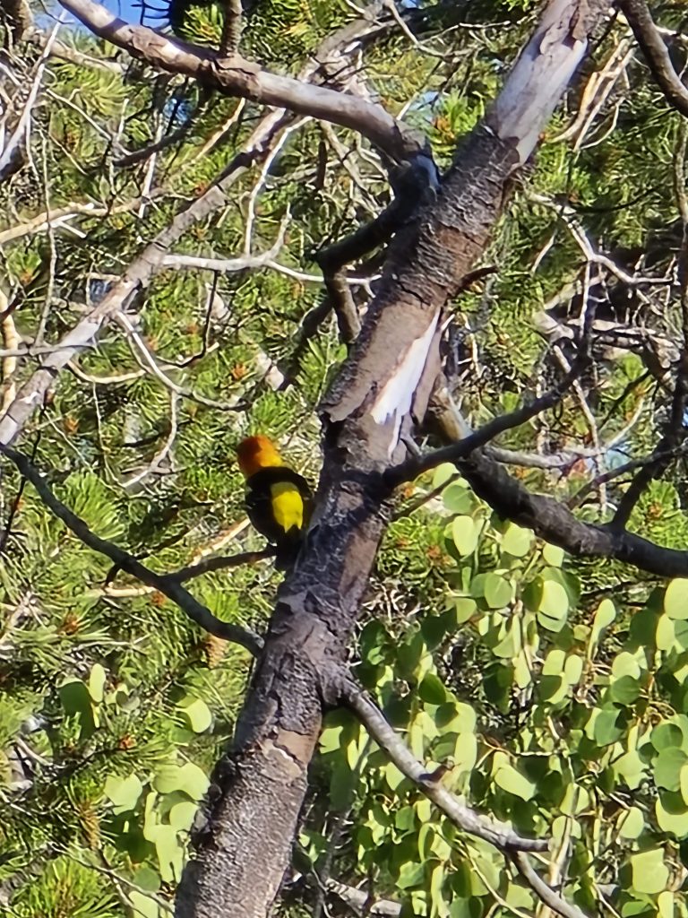
Not only were we pleasantly surprised by the colorful wildflowers still in bloom at Page Meadows, but we were also treated to multiple sightings of male and female western tanagers and even a mountain bluebird (which, sadly, I wasn’t able to capture in a photo).

We completed our loop through Page Meadows and headed back home.
A funny thing that happened on this hike through Page Meadows, however, is that I spotted a lone Apple Airpod (earbud earphone) in its case along the trail. We looked around for a bit to see if its pair was also in the vicinity, but it was nowhere to be found. So, we picked it up, and when we got home, my husband was able to connect it to a charger, and it powered up.
The next morning, a random vehicle with a family inside showed up in our driveway, asking if we’d found an Airpod. We laughed. Their teenage son had been out mountain biking on Page Meadows Trail, and they fell out of his pocket. He implored his parents to drive to the location being pinged from the missing Airpod that was at our house that morning. They told us they thought it was a long shot and expected they’d be on a wild goose chase in no time. Well, luckily, we were still home when they showed up and were able to return the Airpod to its owner, much to the parents’ surprise.
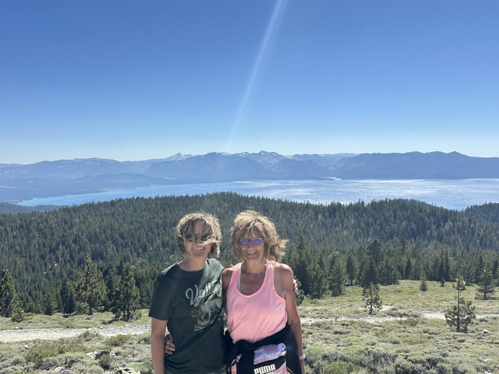
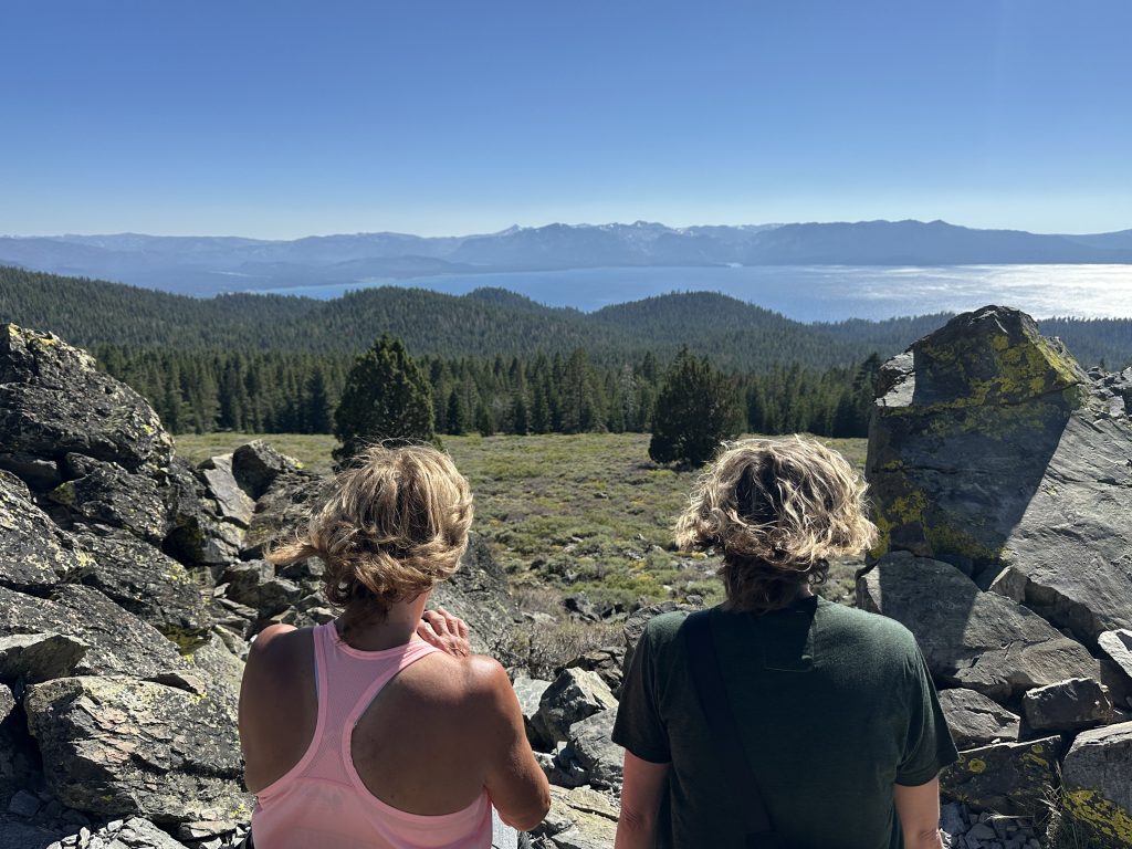
Genoa Peak OHV Trail
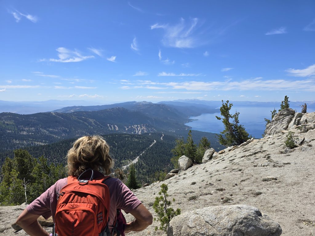
The next day, we drove the Land Cruiser up to Genoa Peak via the OHV Trail for some pretty views of Lake Tahoe. It was beautiful but incredibly windy at the top!
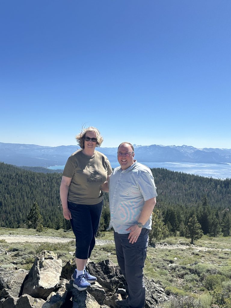
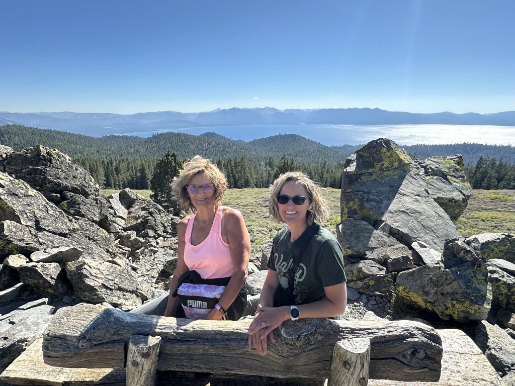
Then we drove over to the short trail that leads to “The Bench” on the Tahoe Rim Trail, and we hiked up to it. (Still windy!)
After our windy off-road adventure, we took our moms to our favorite pizza place, Basecamp Pizza in Heavenly Village in South Lake Tahoe, for some yummy dinner.
Galena Falls Hike
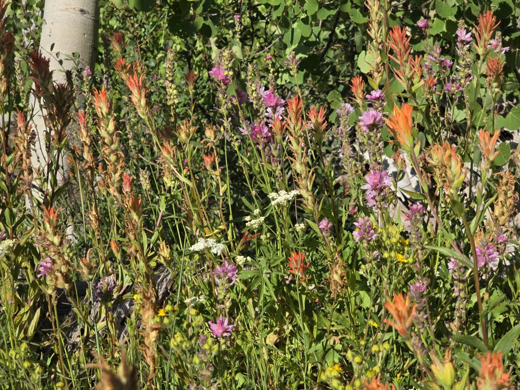
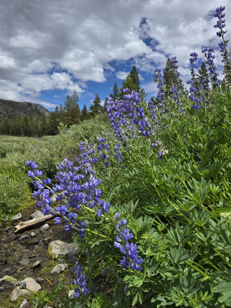
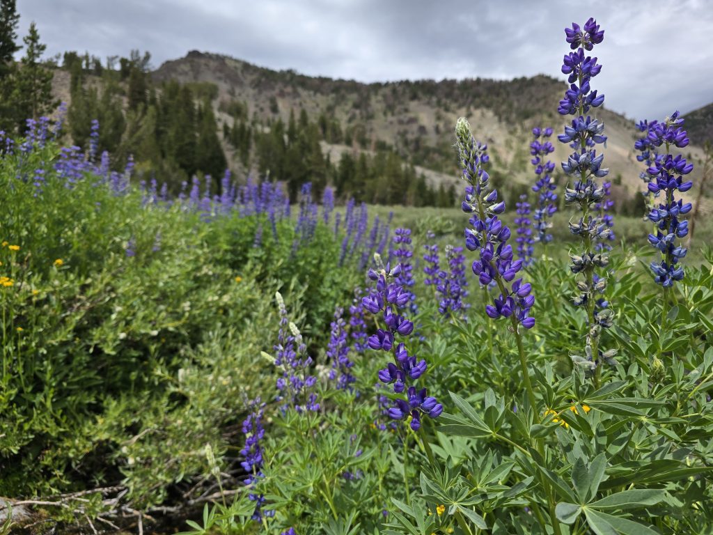
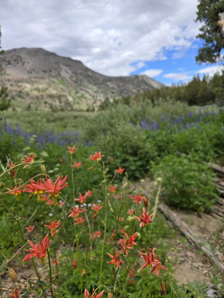
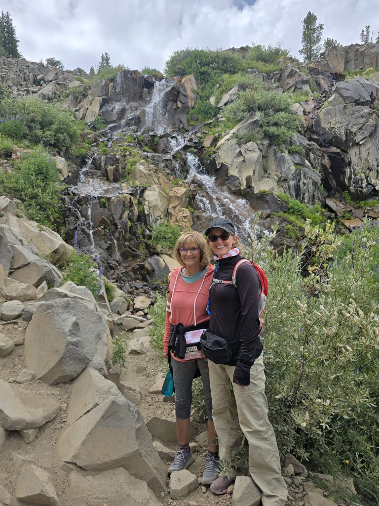
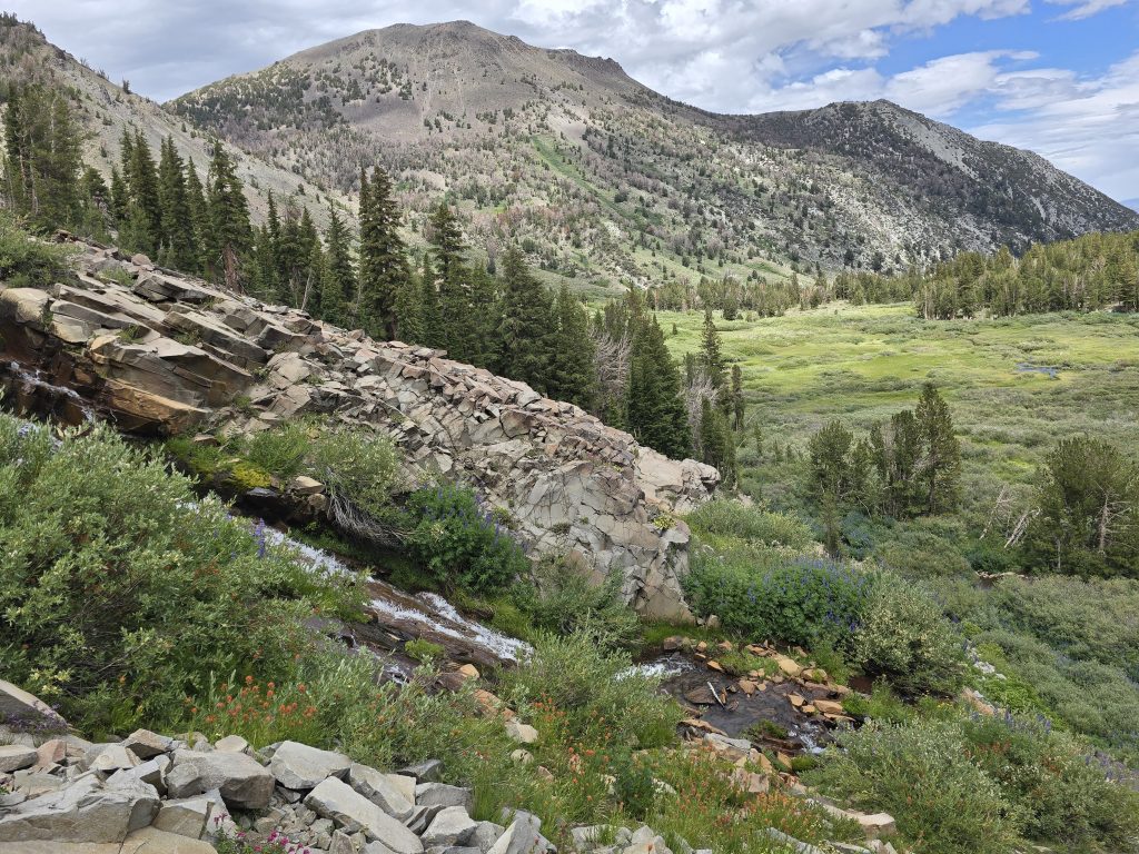
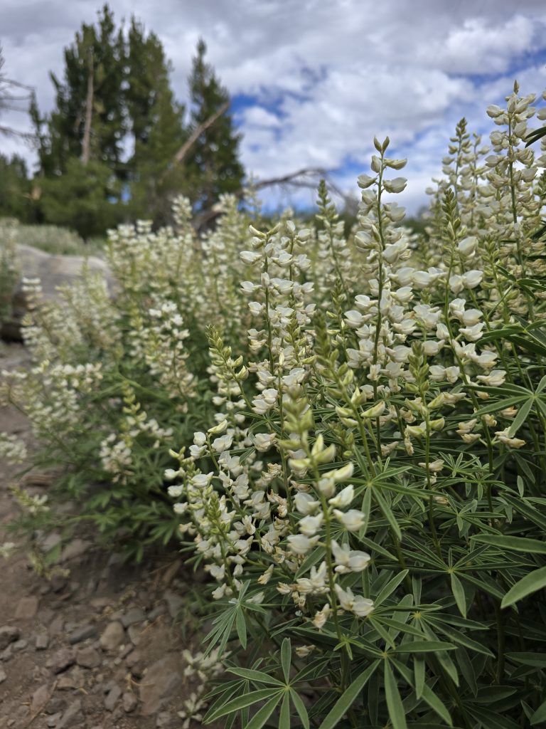
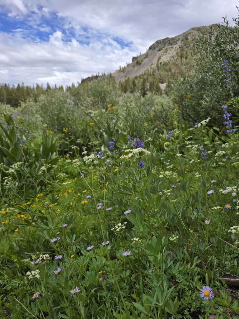
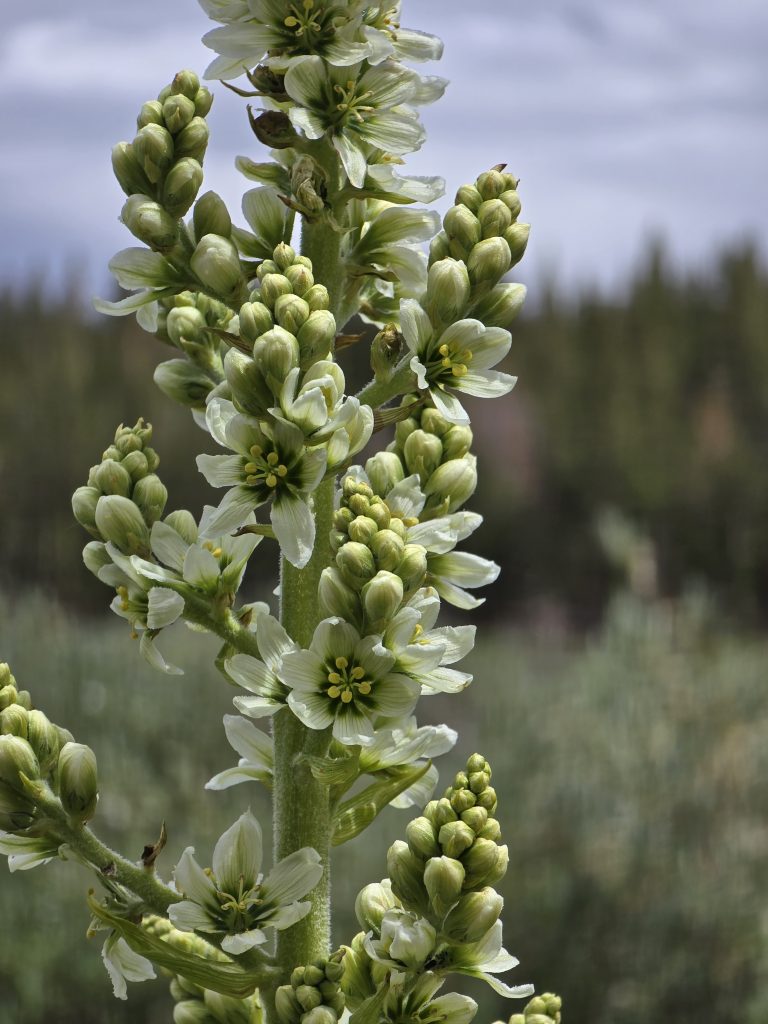
I took my mom on a little “warm-up” hike from the Mt. Rose parking lot out to Galena Falls. I’ve done this hike (or variations of it) numerous times over the years, and I think these were the best wildflowers I’ve seen on this trail.
The trail was relatively busy, but I would not say crowded. Two of the hikers coming towards us were a pair of young teenage boys, fully outfitted with overnight gear. They were by themselves, and I asked them if they’d hiked up to Mt Rose and camped. They said yes, they had, and I told them, “Nice work!” with genuine enthusiasm. With lives now dominated by screens, I always love seeing young people outdoors, enjoying nature, and figuring out how to make it happen, and these two braved it overnight by themselves.

We hiked above the falls a little bit, as well, before coming back down and venturing out on the trail to Mt Rose for a short distance to see more wildflowers.

My mom tackled this high-elevation hike like a champ, and I knew she’d be ready for the hike I had planned for her later in the week. 😉 Maybe next time she comes to visit, I’ll convince her to continue to hike up to Mt Rose!
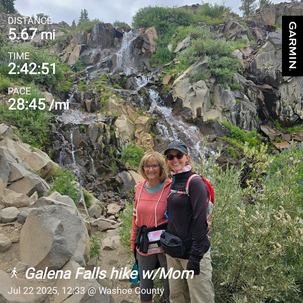
| Galena Falls Hike | |
|---|---|
| Total Distance | 5.67 mi |
| Total Time | 2:42:51 |
| Total Ascent | 643 ft |
| Max Elevation | 9,204 ft |
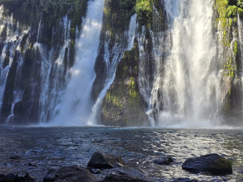
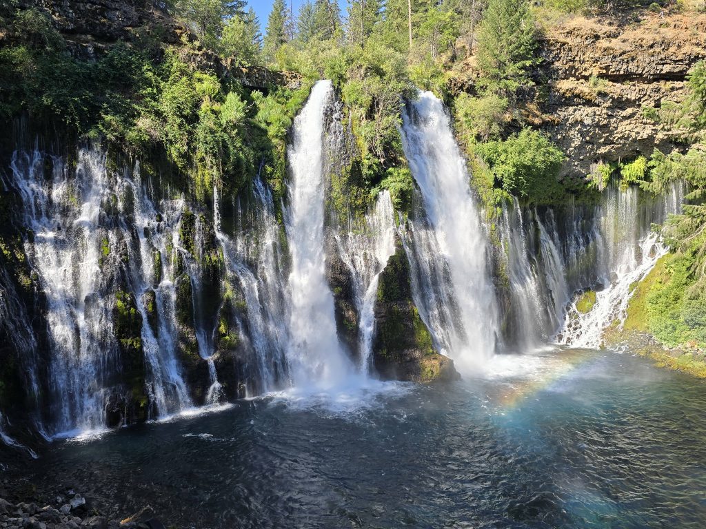
Burney Falls State Park
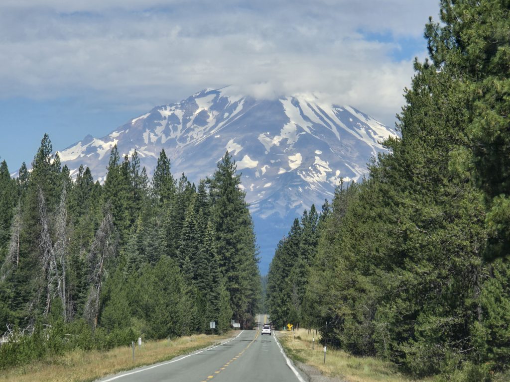
The following morning, we all got up extremely early (we were on the road by 5:00 am) and headed up to Burney Falls State Park, which is about a 3.75-hour drive from Tahoe, so we’d be spending a full day in the area.
Burney Falls is a very popular state park – especially on weekends, which is also why we planned our trip to the falls midweek on a Wednesday – and if you don’t get to the park early in the morning, it is highly possible you won’t even be able to enter or find any place to park.
Of the four of us, my mom was the only one seeing Burney Falls for the first time, but we’ve always loved going there, and I knew she’d love it, too.
When we arrived at the park, we had perfect timing and our choice of parking spaces, with only a few other vehicles having arrived before us.
We headed down the trail to get to the base of the falls. There were hardly any other people there yet!
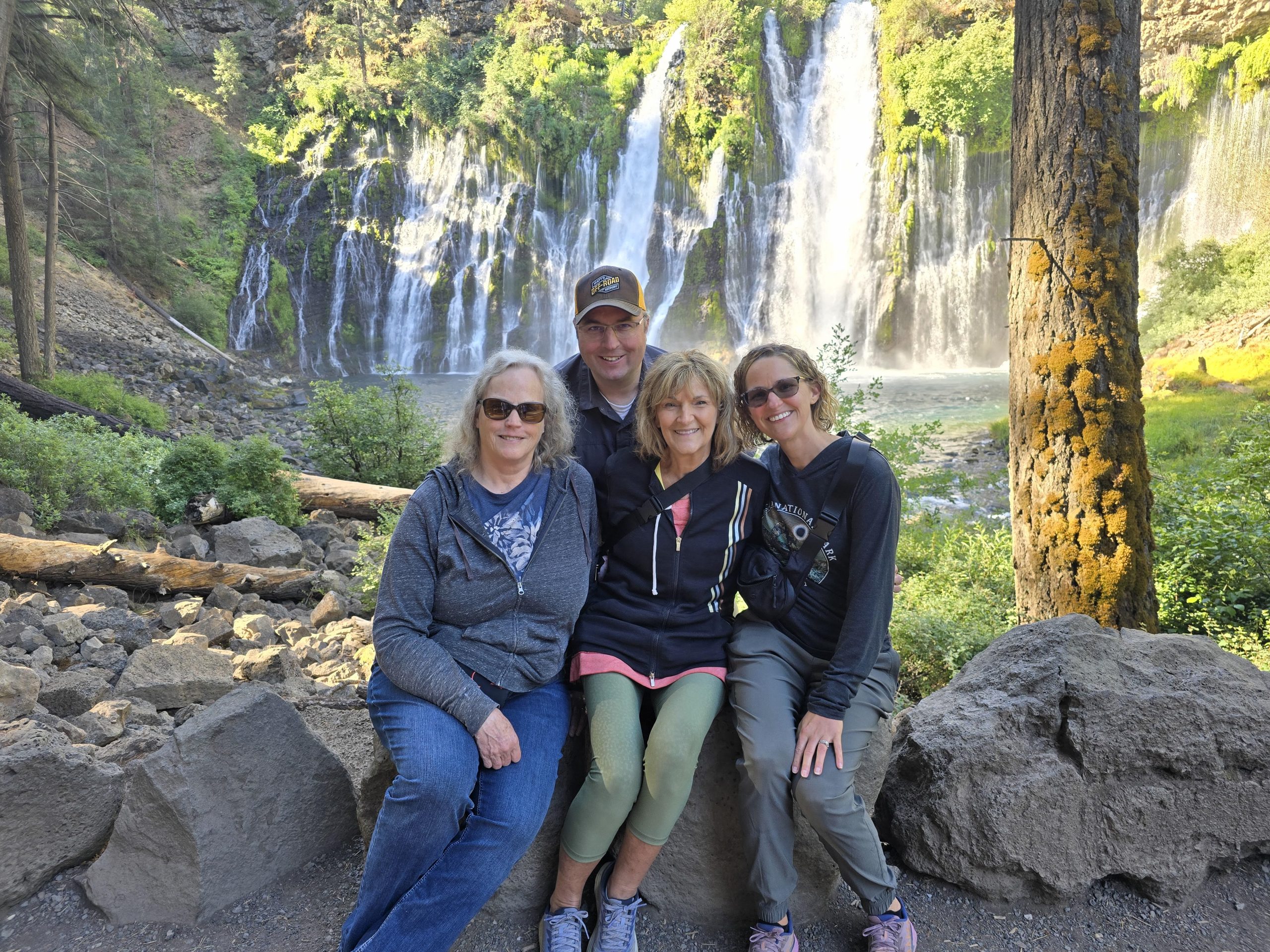
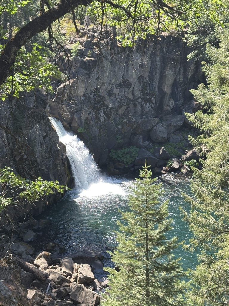
The 129-foot Burney Falls are the biggest that my mom says she has ever seen in person. (I knew she’d love it!)

One of the very few people who happened to be viewing the falls at the same time as us was an older woman by herself named Jean. She used one of those wheeled walkers, and we were all impressed that she had ventured down the path to the falls (and would venture back up, as well).
After chatting with her for a bit, we learned that Jean lost her husband a few years back, but Burney Falls had been a special place for them, so she continues to come back whenever she can. She kindly offered to take our group’s photo at the falls.

We continued on the loop trail past the falls viewing area and made our way back to the upper viewing area.
Of course, we meandered over to the souvenir shop before leaving the park for our next destination.
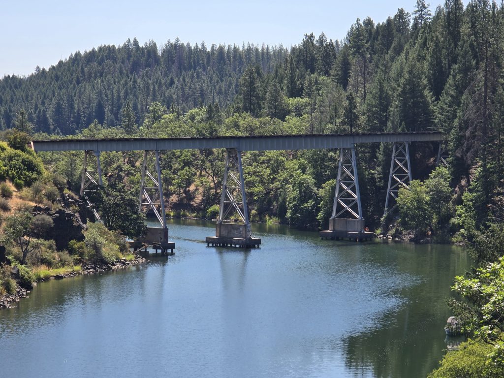
“Stand By Me” Train Bridge
One of the most iconic scenes from the 1986 movie “Stand By Me” is the one where the four friends are crossing a high train trestle across a body of water on their trek to find the deceased body of missing boy, Ray Brower. And suddenly, a locomotive train appears around the bend.
My husband figured out where this “bridge” is located, and so we added this to our itinerary while in the Burney Falls/Shasta, CA, area. In real life, this train trestle spans a finger of Lake Britton and has since been decommissioned as far as the railway is concerned, but it has remained a popular site for film fans.
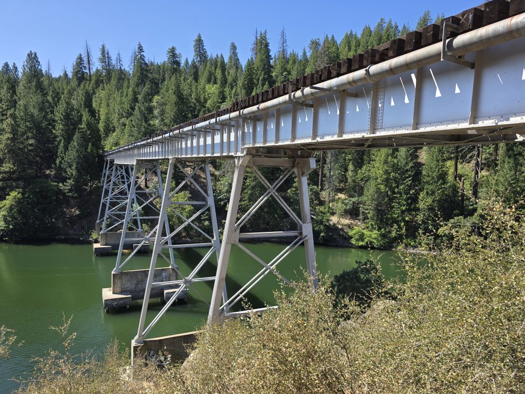
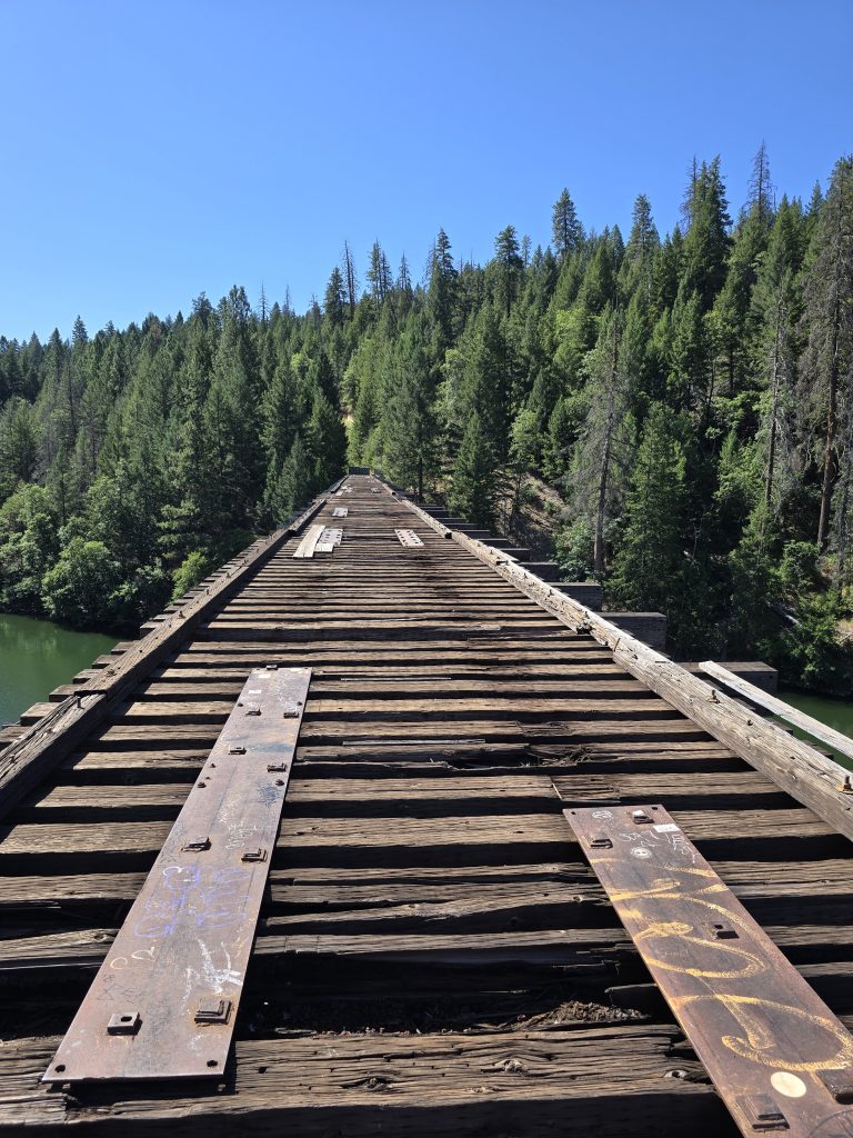
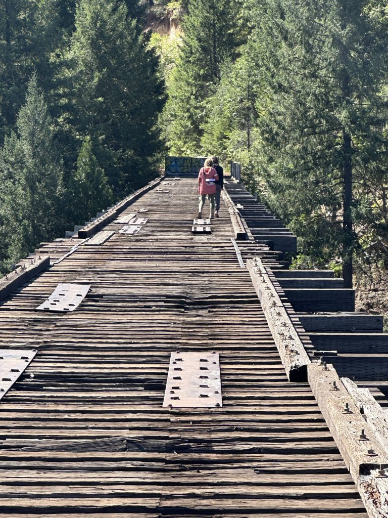
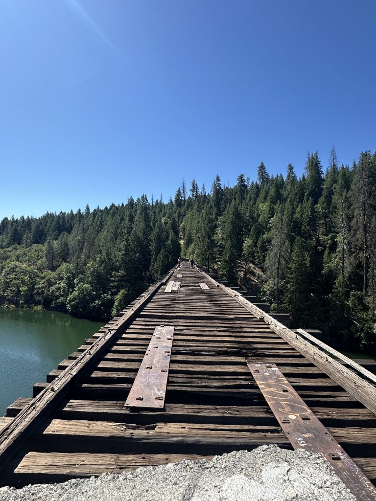
As I was walking across the trestle, looking down at my feet most of the way for safety, as it was a little nerve-wracking, I kept recalling that part of the movie’s train scene where the plastic comb falls out of character Vern’s shirt pocket, and it tumbles through a gap between the railroad ties and disappears down to the water below. I held my belongings tightly and paid close attention to my footing. 😂
Following our train adventure, we headed into Shasta, CA, for some lunch al fresco.
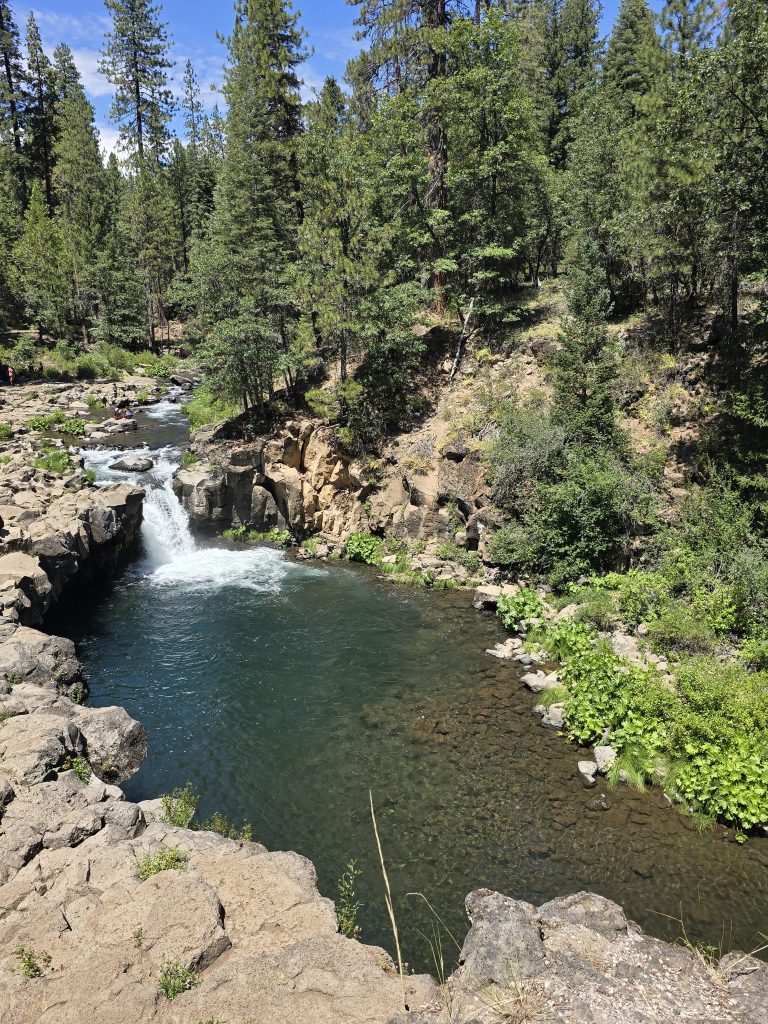
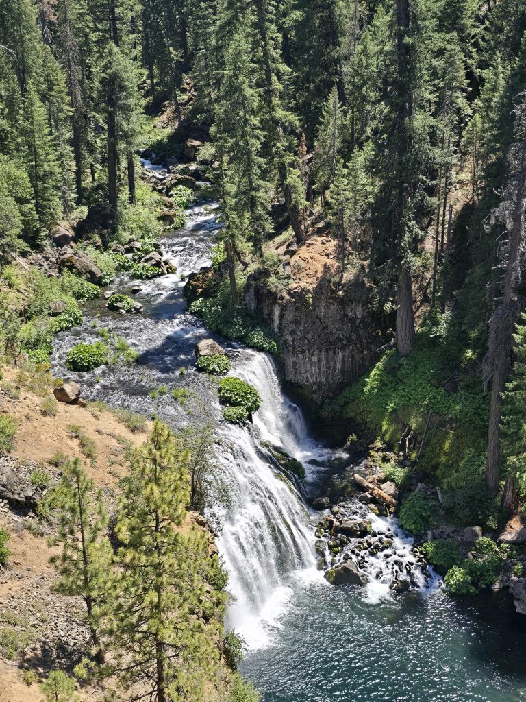
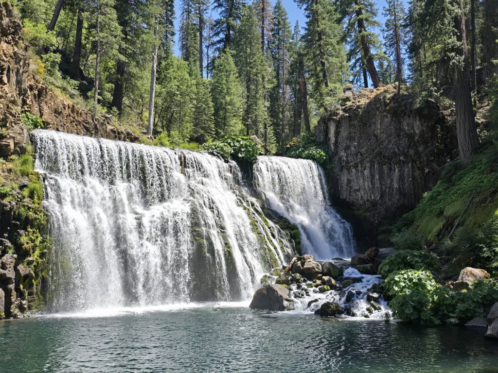
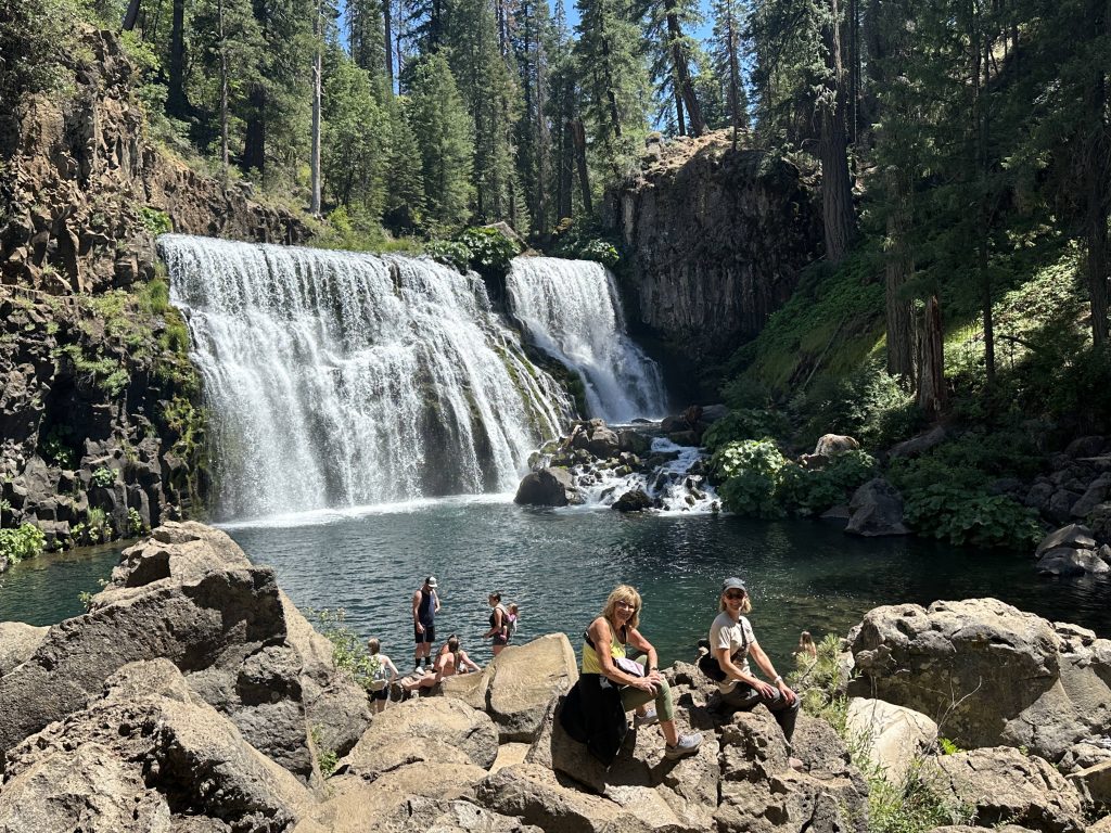
McCloud Falls
My husband and I had previously visited all three of the McCloud Falls – Lower, Middle, and Upper falls. And they are relatively easy to get to, driving from one parking lot to the next. Lower Falls and Upper Falls can be viewed from an overlook above. Middle Falls is more fun to take the short hike down to the water level, in my opinion.
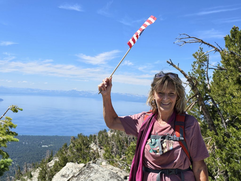
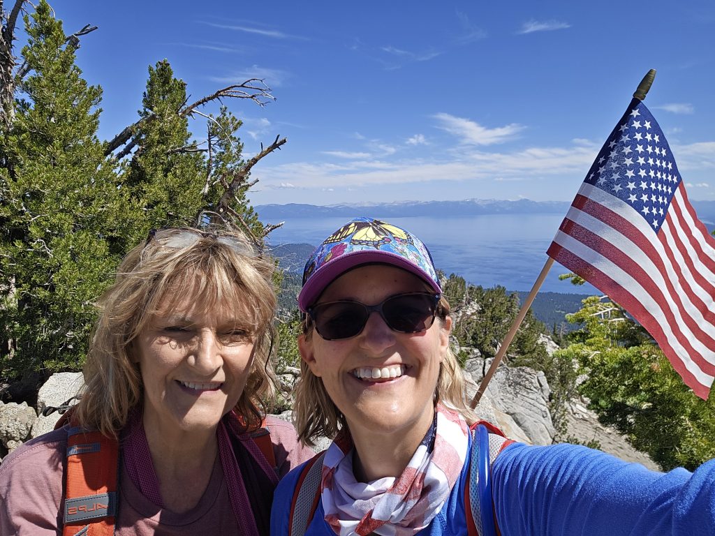
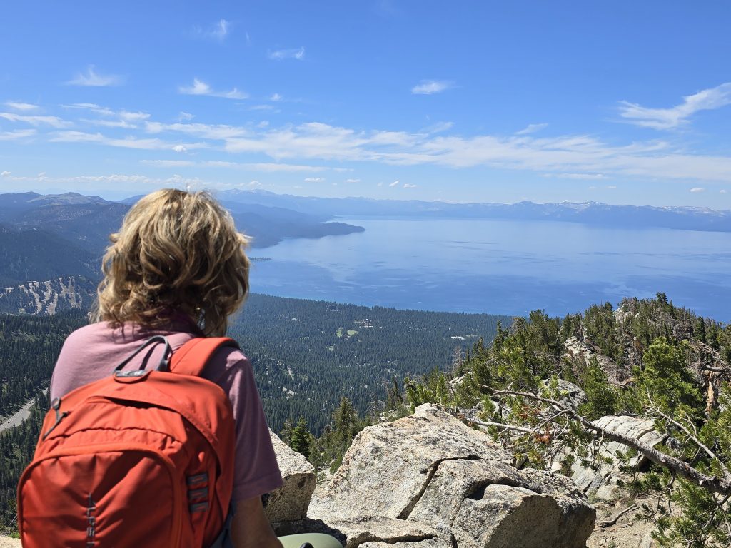
Hike to Incline Peak
Earlier in the week, I convinced my mom that she should hike up to Incline Peak with me. So, we drove up to the trailhead near Tahoe Meadows, got out, and it was windy and cold. I knew there would be no chance my mom would enjoy this challenging hike if the weather was like this. So, we bailed on the hike to Incline Peak that day, hoping we’d have another opportunity before she left.
The day before the moms were scheduled to fly back to the Midwest, I asked my mom if she would be up for one last hike with me, and I mentioned that we could do it first thing tomorrow morning, explaining that she’d have plenty of time yet to finish packing and get to the airport after the hike.
I could sense her hesitation, but I figured I’d let her sleep on it, and I’d bring it up again in the morning, which is precisely what I did.
“Hey, Mom. You want to hike up to Incline Peak with me this morning, then? I know you can do it.”
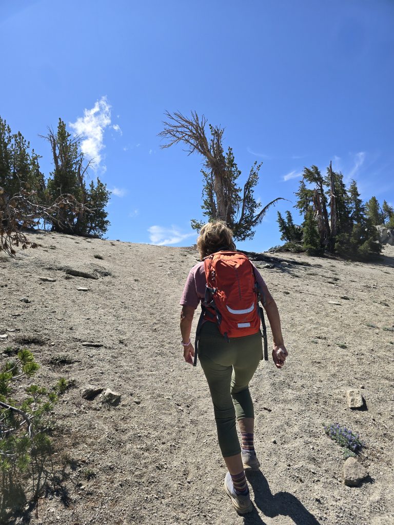
Somehow, she trusted me enough to agree to do it. So, I got her geared up and pumped up, and we headed up to the trailhead for a second shot at this peak.
I have hiked up to Incline Peak lots and lots of times on my own, and I even convinced a group of my cousins who came to visit a couple of years ago to hike to it with me, as well. It was a challenge, but they all made it and felt so accomplished. I knew my mom could do it, even if we kept a slower pace, and I told her she could take as many breaks as she wanted.
The trail starts out on a forest road with a slight decline down to the actual trail, and once you cross the creek, the fun begins, with a non-stop uphill climb to the peak at over 9,400 ft.
My mom was a rockstar, and I was so proud of her. In less than an hour and 15 minutes, she reached the peak in great time, despite the fact that it was high elevation, she’s not really a hiker, and she felt like she was going incredibly slowly and taking so many breaks. (That’s 1,000 feet of elevation gain in two miles to the top.)
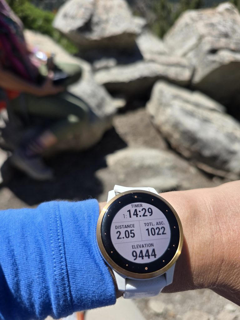
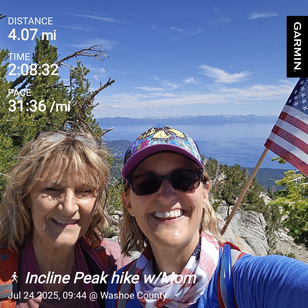
| Incline Peak Hike | |
|---|---|
| Total Distance | 4.07 mi |
| Total Time | 2:08:32 |
| Total Ascent | 1,158 ft |
| Max Elevation | 9,453 ft |
After that amazing feat, I got my mom back to our house with plenty of time to freshen up and finish packing. We were sad to send them off, but we had so much fun with our moms on their summer visit to Lake Tahoe, and we look forward to the next time they can come!
Leave a Reply