
In between March snowstorms in the Sierra, we felt like we wanted to get out and stretch our hiking legs a bit, so we headed to lower elevation for a spring-ish hike along the South Yuba River. The entire South Yuba Trail is 20 miles, but we set out to hike an out-and-back section, totaling about 9.5 miles roundtrip.

Edwards Crossing
The road to our trailhead at Edwards Crossing was paved, but just a narrow single lane with a ravine on one side and the earth on the other, surrounded by overhanging moss-covered trees.

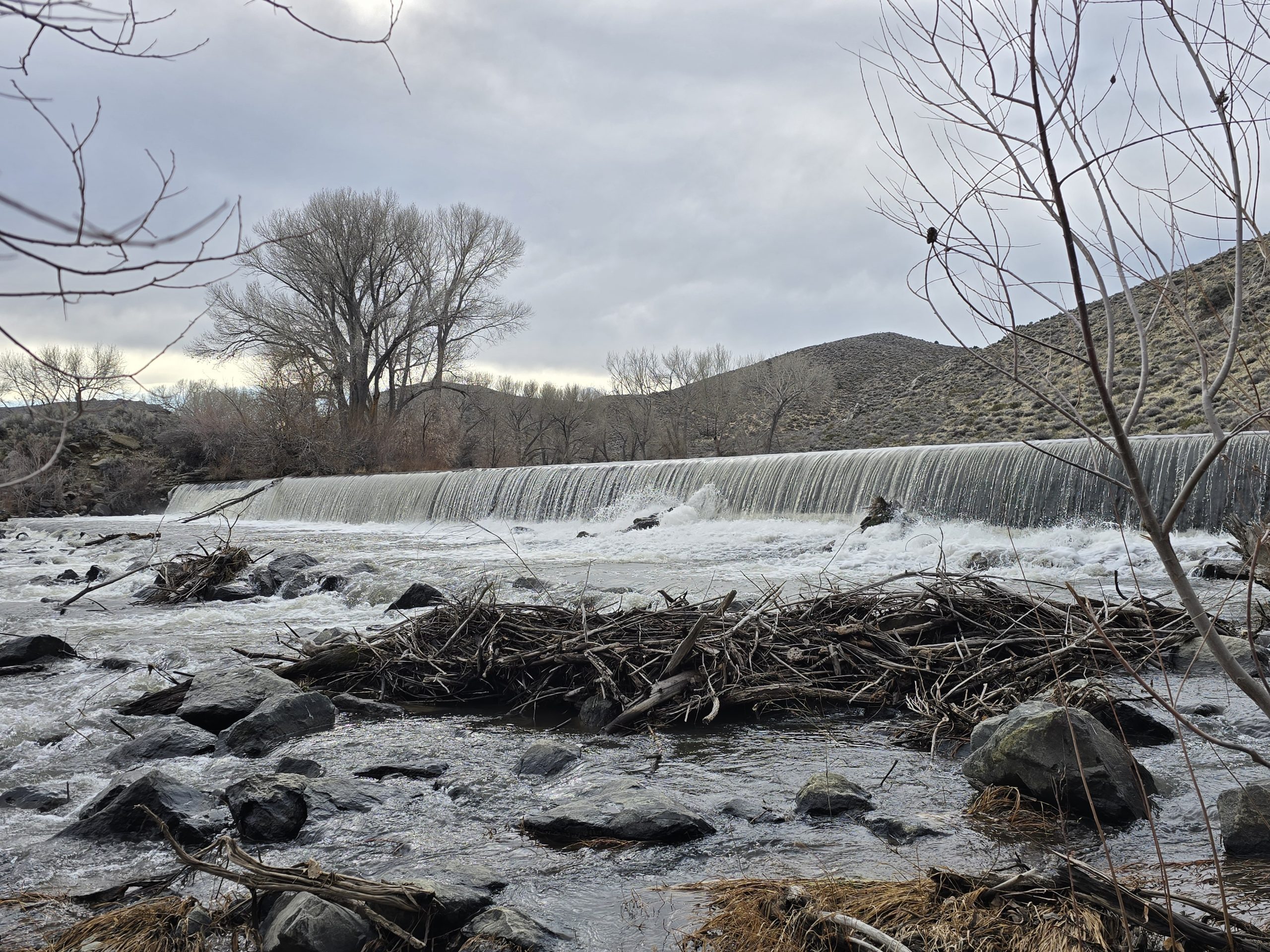
A lovely little waterfall greeted us at the trailhead.

We headed out and, as implied by its name, the South Yuba Trail parallels the South Fork of the Yuba River, which was in a fairly gushing state. Early on in our trek, we spotted a small group of kayakers navigating the rapids.

The South Yuba Trail affords beautiful views of the river canyon and surrounding landscape, which is winding, rocky, and moss-covered.

Much like our previous hikes along the Yuba this time of year, we found ourselves rock-hopping over spring streams and cascades breaching the trail.
Compared to our usual high-elevation hikes in the Sierra, seeing thick green moss along the trail is always notable.


The trail was pretty rocky overall, but this one section was especially so, likely due to a rockslide at some point in time.


The South Yuba Trail cuts through the rocky cliffs and bluffs of the river canyon, winding up and down and around. Very little of the trail was flat terrain; most of it was either climbing or descending.
With all the moisture present along this trail, it wasn’t too unexpected to see a frog, but it was pretty tiny – maybe the size of a nickel – so it was a little surprising that we were able to spot it amongst all the green. He hopped when I happened to be looking down at the trail, so it caught my eye. I looked it up and it is a Pacific Tree Frog.

We even came upon some magnificent old-growth redwood trees along the South Yuba Trail.

And we spotted a few wildflowers along the trail, including Pacific Hound’s Tongue.

Purdon Crossing
Nearly 4.75 miles in, we reached the historic bridge at Purdon Crossing, which was also our turnaround point. A friendly hiking couple offered to take our photo after we’d taken theirs.

(This was not our first time photographing the Purdon Bridge!)
According to the onsite signage, the steel Purdon Bridge was erected in 1895, replacing several wooden bridges washed away in floods. It is the only remaining bridge in California of the half-through truss design. Purdon Crossing was a vital link of the main road from Nevada City to Downieville and the northern mines.
At this point, we turned around and headed back to the trailhead at Edwards Crossing. But first, we found a nice big boulder to sit upon along the river and enjoyed a quick snack before continuing on our return route. Neither of us was really looking forward to all the “ups” we’d encounter. In this case, what goes down must also go back up.
A nice spring hike on the South Yuba Trail was a great way to spend the day outdoors amongst the small waterfalls, glowing green moss, tiny tree frogs, giant trees, cute wildflowers, and a rushing South Yuba River.

| South Yuba River Trail | |
|---|---|
| Total Distance | 9.46 mi |
| Total Time | 4:05:43 |
| Total Ascent | 1,591 ft |
| Max Elevation | 2,203 ft |
Leave a Reply