Jump to:
After a very successful day yesterday with a hike to the Pacific coast where we got to see orcas swimming in the ocean and our first blush with tide pools, today’s adventures would include, yes, more waterfalls!
The family from Minnesota that we’d met at the World’s Largest Sitka Spruce Tree recommended that we spend time in Sol Duc while on this amazing trip to Olympic National Park. So, on Day 3, we headed east on Hwy 101 from our basecamp in Forks, WA, for about an hour to the Sol Duc area near Lake Crescent.
Sol Duc Valley


After arriving in Sol Duc Valley to start our hike, we parked in the hot springs resort parking lot and headed towards the trailhead for Lover’s Falls and Sol Duc Falls. I don’t know if I’ve ever seen so many shades of green in my life as we did on this trail through temperate rainforest, surrounded by a canopy of old-growth trees, along with ferns, mosses, and lichen.


We came to a bridge spanning across a rushing creek that flows into Sol Duc River. The bridge only had a railing on one side!


Chad definitely wore the right colored shirt today. 😂


The trail to Lover’s Falls mostly parallels Sol Duc River from various distances, but then we could hear the rushing water and soon the trail meandered even closer to it.
The scenery along the trail to Lover’s Falls was lush and green and beautiful.
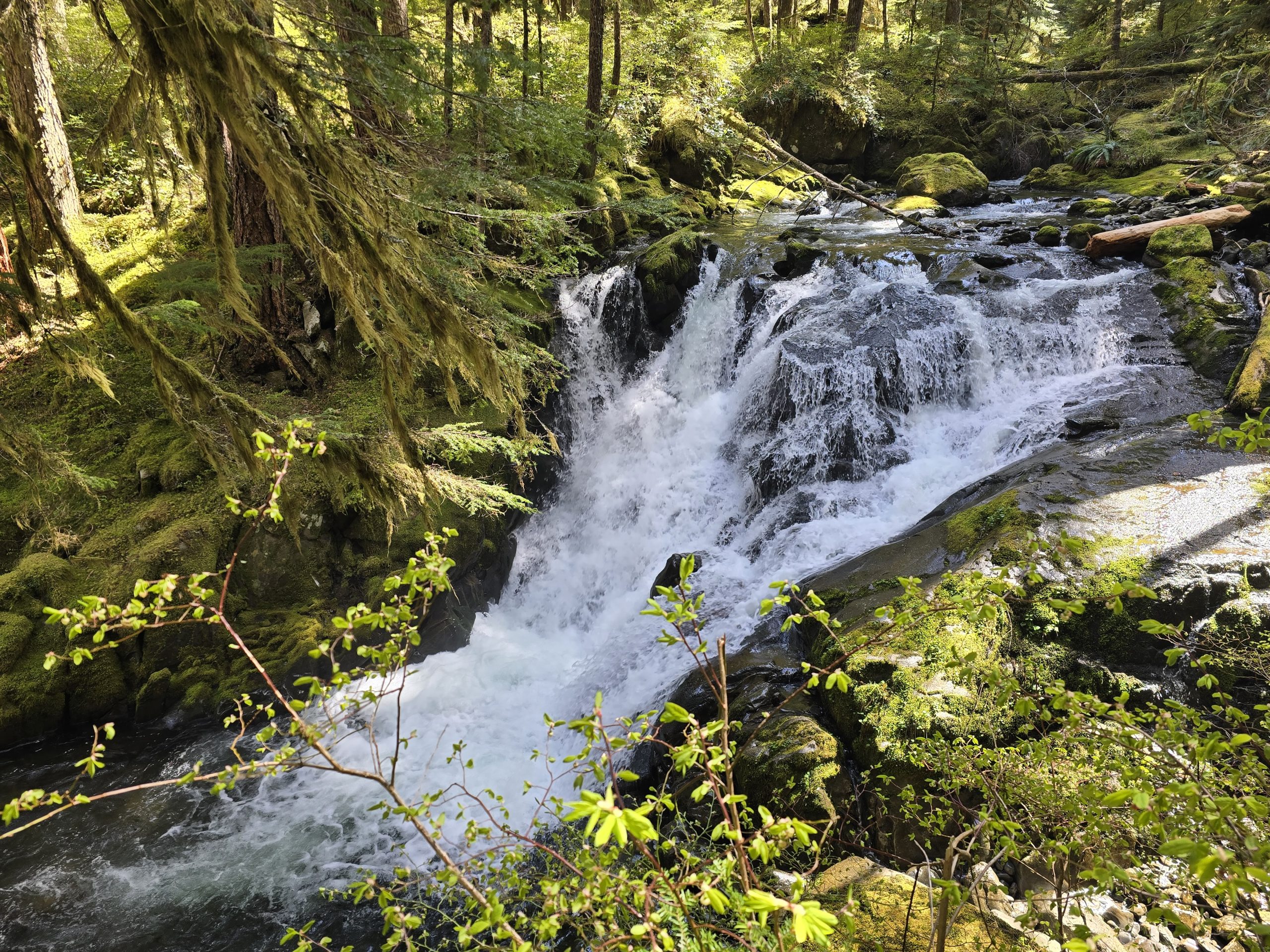
Lover’s Falls

Our first destination on this hike was Lover’s Falls.


After taking in the sights and sounds at Lover’s Falls, we continued on to our next destination along the trail: Sol Duc Falls.
Sol Duc Falls
Lover’s Falls was nice. Sol Duc Falls was powerful. And it was very obviously a prime hiking destination for many a tourist, and tourists of all ages – from toddlers to the elderly. It wasn’t crowded, but it had many more people than most of the other falls we’d visited on this trip.


Side Note: Tragically, in June 2025, just two months after we’d been at Sol Duc Falls, an 18-year-old man fell over the falls, resulting in a recovery operation, during which the area was temporarily closed. May he rest in peace.
We continued on our roughly 6.5-mile loop back to the hot spring resort where we found an open picnic table and enjoyed our PB&J lunch before heading back out.

| Lover’s Falls & Sol Duc Falls Loop hike | |
|---|---|
| Total Distance | 6.46 mi |
| Total Time | 3:10:16 |
| Total Ascent | 509 ft |
| Max Elevation | 1,990 ft |
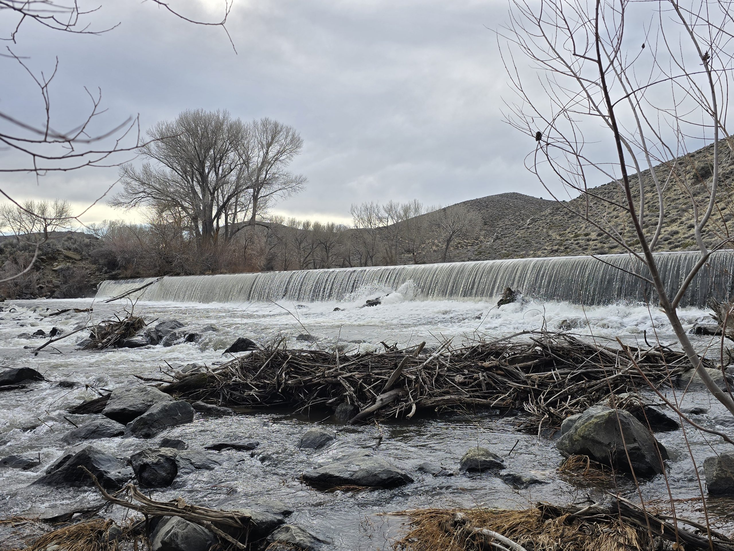
Salmon Cascades & Leaping Coho Salmon
Our next destination was kind of a spur-of-the-moment stop at the roadside Salmon Cascades. To our astonishment, we were treated to coho salmon leaping their 11 feet up the cascades!
Fascinating coho salmon facts according to the on-site signage:
“Born in gravelly river beds above the cascades, thousands of juvenile coho salmon memorize river scents on their 70-mile swim to sea. For up to two years, coho range hundreds of miles from Oregon to British Columbia. Ocean temperatures and salinity, angle of the sun and magnetic fields help guide them back to the Sol Duc River.”
From there, we drove back toward Lake Crescent for the trailhead to Marymere Falls.
Marymere Falls
We parked near the Storm King Ranger Station and hopped on the trail to Marymere Falls, which started out going through a tunnel beneath Hwy 101, and then we were definitely entering the lowland forest of old-growth trees. It was a short, roughly one-mile walk to Marymere Falls, but the trail entailed quite a bit of stairs.
To me, the 90-foot Marymere Falls was the shape of a wine bottle.


| Marymere Falls hike | |
|---|---|
| Total Distance | 2.20 mi |
| Total Time | 57:02 |
| Total Ascent | 256 ft |
| Max Elevation | 806 ft |
Lake Crescent
We made it back to our vehicle and decided to add a brief roadside stop along picturesque Lake Crescent. On the day of our arrival for this trip, we drove past Lake Crescent on our way from SeaTac airport to our basecamp in Forks, WA, so I was glad we had an opportunity to stop this time. (More to come from Lake Crescent…)


After a pretty full day of hiking, sightseeing, and exploring in Olympic National Park, it was time to start heading back towards our basecamp in Forks. Plus, we were all getting pretty hungry for dinner.
Maybe it was because we were there during the shoulder season, but the restaurant scene in and around Forks was a little limited, especially for places open later in the evening, when we were usually returning after our full day of adventures.
As we were searching for a nearby place to stop and grab a bite to eat, we discovered 3 Rivers Resort, which was only open for another half hour when we arrived, but we made it just in time for a few burgers and some ice cream. What we weren’t expecting at 3 Rivers Resort was 1) we’d be inundated with paraphernalia, artifacts, and mementos from the “Twilight” series and 2) that Chad was secretly a huge fan of “Twilight.”

During our trip-planning phase, Forks was chosen as our basecamp, but it wasn’t until we were driving together from SeaTac to Forks that Shannon informed us that Forks has some kind of affiliation with the “Twilight” series. (I’ve never read the books or seen the movies, but I had a general awareness of it.)
While we waited for our food, Chad wandered around this quasi-museum, taking photos. I think he said he was sending them to his sister, but I guess we’ll never know… 😂
Rialto Beach
Still having a little bit of daylight on our side, following our dinner, we drove about 5 miles west toward the Pacific Ocean coast to Rialto Beach.

The beach is littered with piles of massive driftwood. In fact, we had to climb over a bunch just to get from the parking lot to the water.


A majestic capstone for our day, as we were leaving the beach area, we spotted a bald eagle perched along the mouth of the Quillayute River near Rialto Beach!

Tomorrow will be an early start to the day as we head back to the coast for a low-tide excursion!
Leave a Reply